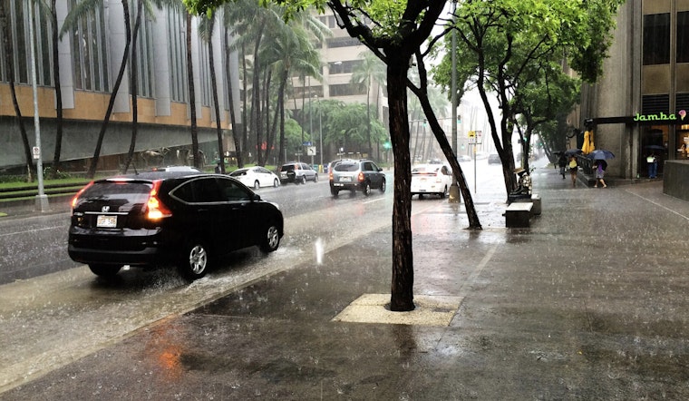
Honolulu is set to experience wetter weather as two cold fronts approach Kauai. Brief showers are expected over the western islands, with variable winds throughout the week. As one front stalls near Kauai today, Oahu and neighboring islands may see a temporary decrease in rain, though another system is forecast to bring thunderstorms early next week, according to the National Weather Service (NWS).
Current conditions show a shallow cold front approaching Kauai, bringing scattered showers and potential downpours, with rainfall amounts possibly exceeding an inch, especially in the northern and interior areas of the island. The weather service reports that vog is expected to persist over the islands for a few days, which may affect air quality and visibility for some residents. A high-pressure system will bring a brief period of more stable conditions and easterly trade winds by Saturday night. However, the next front is expected to bring showers and possibly thunderstorms into next week.
Aviation alerts are in effect due to strong high pressure affecting air travel. The NWS warns that a front moving over Kauai may cause widespread mountain obscuration. Shifting winds are expected to create varied flying conditions across the islands, with land and sea breezes likely to dominate in areas such as Maui and Hawaii Counties due to lighter wind flows.
For those with marine interests, caution is advised as light to moderate southerly flow will continue ahead of another swell expected to build, which could bring surf into the High Surf Advisory (HSA) range. As the front approaches and subsides near Kauai, an expansive high-pressure system will build north of the state. The NWS projects moderate easterly or east-southeasterly flow across the waters, and a Small Craft Advisory (SCA) may be issued due to the expected seafaring conditions by tonight over the northern and western waters. By Sunday night, a long-period swell from a deep low-pressure system southeast of Russia's Kamchatka Peninsula is expected to reach the islands, peaking by Monday night.
The High Surf Advisory remains in effect until 6 p.m. HST Saturday for various shores, so beachgoers and marine enthusiasts should exercise caution and monitor conditions closely. With waves expected to simmer down by mid-week, the NWS suggests that surf along east and south facing shores should remain small.


.jpg)