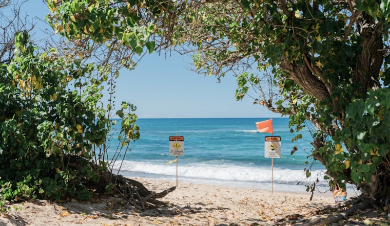
Residents along Florida's coastline are urged to exercise caution as the National Weather Service in Tampa Bay has issued a high rip current risk warning effective through Thursday morning. According to the NWS alert, hazardous rip currents are expected along the shores of Pinellas, Coastal Hillsborough, Coastal Manatee, Coastal Sarasota, Coastal Charlotte, and Coastal Lee Counties, posing a serious risk for beachgoers and swimmers.
The Rip Current Statement details that "dangerous rip currents" can pull even strong swimmers out to deeper waters, highlighting the need for awareness and safety measures while near the ocean. For those planning to hit the beaches, the National Weather Service advises swimming near a lifeguard and recommends that if one is caught in a rip current, to "relax and float" instead of swimming against the current. If possible, swimmers should follow the shoreline, and if unable to escape, they should signal to the shore for assistance.
To accompany the coastal hazard message, the local weather forecast for the Tampa area, provided by the National Weather Service, anticipates mostly sunny skies with high temperatures nearing the 80s over the next few days. Evening conditions are expected to remain mostly clear, with lows dipping into the 60s. This window of warmer weather includes a slim chance of showers on Friday night, though clear skies will likely return shortly thereafter.
Moreover, the NWS forecast predicts that come the weekend, conditions are set to remain sunny, with gusty winds as high as 21 mph on Saturday. However, despite the serene weather, beachgoers should remain vigilant of the ongoing rip current risks and adhere to safety precautions. The full scope of the weather conditions and the impact of the rip currents on local events and daily life remains to be seen as the community braces itself for these dynamics of nature.


