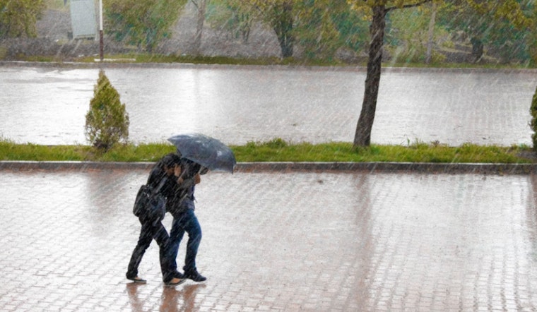
Las Vegas residents should be prepared for continued inclement weather as a strong low pressure system makes its presence known through the region, according to the National Weather Service Las Vegas NV. The forecast suggests cooler than normal temperatures along with multiple showers and thunderstorms set to hit the area today and tomorrow. The slight relief in the heat may sound welcoming, but these conditions bring additional hazards such as moderate showers, sudden gusty winds, and frequent lightning strikes.
The current weather seems to have the city in a bit of a hold; an upper-level trough is driving the convection, which is expected to directly hover over southern California. The National Weather Service details that a band of more intense convection is currently moving through southern Clark County, with showers and thunderstorms just starting to push into surrounding areas. While the lower levels of the atmosphere are set to become more saturated—an anomaly for this time of year, with precipitable water values over 200% of normal—widespread flash flooding is not anticipated. However, isolated flash flooding could still occur with stronger thunderstorms that manage to produce heavy rain amidst the more moderate showers.
Despite the tumultuous weather, not all hope is lost for a return to sunshine and dry skies. The long-term forecast indicates that conditions will dry out with temperatures climbing back to above-average by the end of the week and into the weekend. As Tuesday rolls around, discrepancies in ensemble modeling may affect how quickly the low-pressure system will exit the region, yet it signifies a potential decline in adverse weather impacts, particularly for southwestern Nevada and the Colorado River Valley.
For aviation interests, like Harry Reid International Airport, the forecast period is characterized by erratic gusty winds, potential MVFR/IFR conditions, and lightning strikes associated with periodic showers and thunderstorms. Pilots and passengers should be ready for intermittent impacts at the terminal, including variable wind patterns and visibility concerns. Post-daybreak Monday, another round of showers is predicted, and a northwesterly wind shift should be expected away from any convection or associated outflow boundaries. These weather changes have sparked a call to action, as the National Weather Service encourages spotters to report any significant weather or impacts as they occur.


