Las Vegas residents and visitors should brace themselves for a weekend of volatile weather. With a potent low-pressure system moving through the Desert Southwest, the forecast predicts gusty winds, isolated to scattered showers, thunderstorms and a noticeable drop in temperature throughout the region until early next week, according to the latest advisory from the National Weather Service Las Vegas, NV.
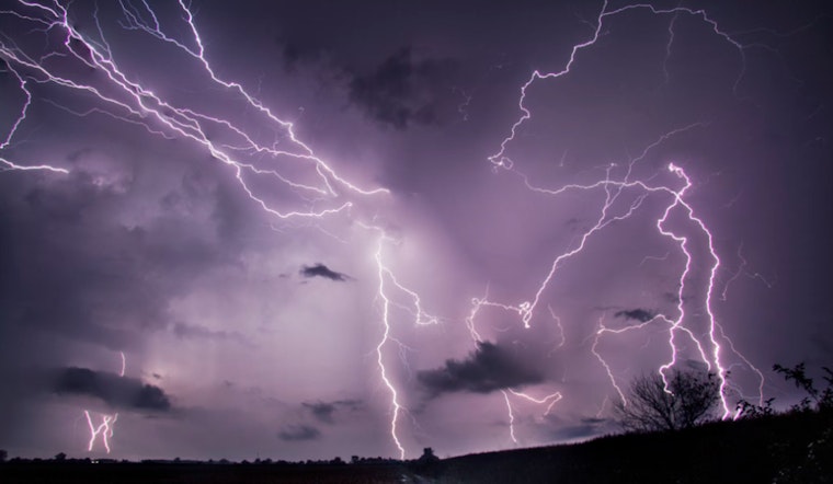
A Wind Advisory is currently in place for the western Mojave Desert, effective from this afternoon through Sunday early morning. The area is expected to experience wind gusts peaking at 45 mph. Along with the strong winds, this weather system is also bringing an influx of moisture between 150% to 225% above normal, making conditions ripe for thunderstorm development across the Las Vegas Valley. The National Weather Service warns of potential lightning, moderate rainfall, gusty outflow winds, and even the chance for small hail.
As night falls, the bustle of city life usually outshines forces of nature, but tonight might be an exception. Unlike typical patterns where convection subsides after sunset, the forecast indicates that the upper-level trough will provide ongoing lift, increasing the likelihood of showers and storms throughout the night into Sunday. This will bring widespread precipitation chances, ranging from 50 to 90%, with the worst expected on Sunday. Nye County and eastern Esmeralda County may see the brunt of it, with a possibility of severe storms capable of producing wind gusts that exceed 58 mph.
The cold front accompanying this system will bring temperatures down by 10 to 15 degrees across the forecast area. Elevations above 8,000 feet may even see a late season snow, issuing a Winter Weather Advisory for the Eastern Sierra Slopes with up to 6 inches of snow in the higher terrain. Although continuous showers and thunderstorms are not expected, the risk of water pooling on roads and in dry washes could compromise travel safety, especially on streets dusted with the dirt and oil buildup from drier spells.
Looking ahead to the middle of next week, the storm's residual effects will persist with a chance of showers and a few storms lingering into Wednesday. However, the region is set to experience a warmup from Thursday as a broad upper ridge develops across the Desert Southwest, indicating a return to drier conditions and temperatures above seasonal averages by the weekend.
For aviators, the Harry Reid International Airport is anticipating elevated and gusty southwest winds, with gusts likely reaching 20-25 knots through the early evening. Furthermore, scattered showers and potential thunderstorms could cause disruptions, though the exact impact on airport operations remains uncertain at present. "Confidence is high in the development of showers and thunderstorms across the Las Vegas Valley, however, confidence is moderate to low when it comes to timing impacts at the terminal," the National Weather Service cautions. Pilots and travelers should be prepared for erratic gusty winds, lightning, and possible MVFR/IFR conditions in heavier rain phases around the storm system.
Spotters are on alert and have been urged to report any significant weather occurrences or impacts in line with standard operating procedures. Travelers and locals should remain vigilant and stay informed by monitoring updates and potential amendments to weather advisories.


