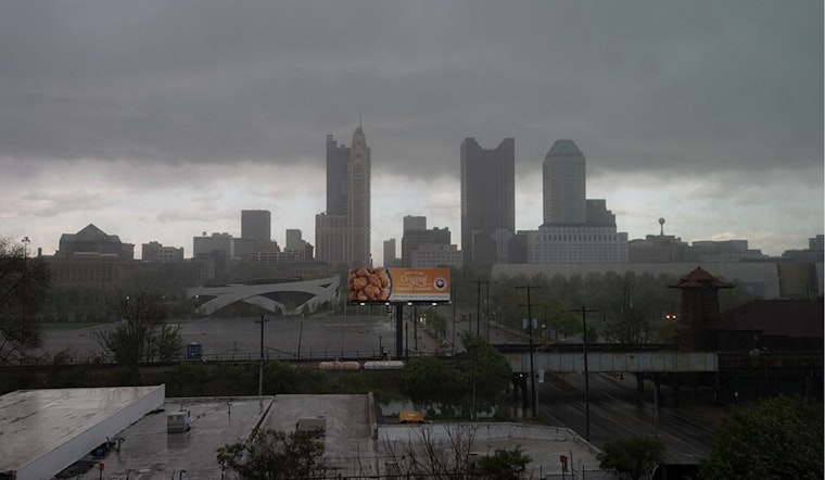
The National Weather Service Wilmington OH has announced that a warm front is set to approach the Ohio River today, introducing a spell of showers and thunderstorms that are expected to rattle the area into Wednesday. The National Weather Service's forecast, as per their Area Forecast Discussion, indicates an upper level low that will drop southeast across the Great Lakes, leading to cooler and unsettled conditions later in the week.
Conditions are set to get wet as the initial shortwave and isentropic lift will result in rain showers overspreading from the southwest ahead of the warm front. "Some embedded thunder is likely this morning across the southwest," the forecast explains, signaling a possibility of very marginal elevated instability. Furthermore, the possible stalling of the warm front near the Ohio River brings a lot of uncertainty in the forecast, potentially affecting the amount of instability and thus the severity of the weather conditions.
As the day unfolds, convective activity is expected to increase during the afternoon into the evening as another shortwave passes through. This could lead to severe weather, especially near and south of the warm front's stalling point, which may affect far southern counties of the forecast area. The emphasis is also on the high moisture content of the air, which means heavy rainfall could lead to flash flooding scenarios. Due to decreasing instability, the severe weather potential drops off as one travels north from the warm front.
The NWS also outlines a temperature profile for the affected area, with highs stuck in the 60s to the north of the warm front but warming into the lower to mid 70s to the south of it. Overnight lows are expected to span from the lower 50s in the north to near 60 in the south. "Cool temperatures with highs Wednesday from the mid 60s northwest to near 70 southeast," the NWS report continues, highlighting a persistent cool spell into mid-week. Aviation interests should brace for widespread MVFR ceilings with a potential drop to IFR conditions in heavier showers.
Looking towards the end of the week, things are not set to improve quickly. The area is in for cooler-than-normal temperatures as surface low pressure makes its way northeast. However, Friday brings some respite as sunshine is expected to return and continue through Saturday. "In the cooler pattern, we have kept low chances of hazardous weather in the HWO during the extended period," concludes the NWS's forecast, giving a glimmer of optimism amidst a notably damp outlook.


