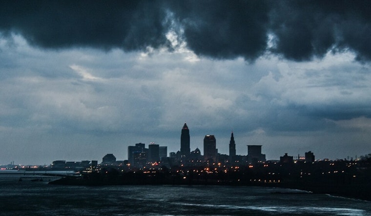
The National Weather Service in Cleveland has anticipated a mix of scattered rain showers and isolated thunderstorms for the Northeast Ohio region, significantly along a line from Findlay to Mansfield to Meadville, PA. According to their morning Area Forecast Discussion, this weather pattern is expected through early evening due to isentropic ascent and frontogenetical convergence surrounding the moist warm conveyor belt of a deepening surface low.
A cold front is set to sweep southeastward across northern Ohio and northwest Pennsylvania this evening, with additional scattered showers likely to persist. There will be chances of isolated thunderstorms until the early morning hours on Saturday. The NWS urges residents to stay updated as temperatures are forecasted to dip behind the front, with overnight lows reaching the upper 40s to mid-50s, with even cooler temperatures in some areas on Saturday night. The introduction of a ridge from the western Great Lakes has been slowly anticipated to usher in a slight warming trend for the remainder of the weekend.
Aviation forecasts remain under the influence of primarily westerly to northwesterly winds, which are projected to introduce widespread MVFR ceilings and even a possibility of IFR conditions post-front. "Isolated thunderstorms with MVFR to IFR are possible late this afternoon through 12Z/Sat," cited from the NWS discussion. Pilots and travelers should anticipate changes and exercise caution.
The Great Lakes maritime community should be aware of impending higher winds and waves, particularly on the central basin, cautioning toward “a Small Craft Advisory for areas from Vermilion to Conneaut,” which also implies a high swim risk. Boaters and the general public should heed local advisories and maintain a close watch on developments, especially considering conditions may only improve by Monday with a front expected to arrive by mid-week, bringing potential showers and a shift in temperatures.


.jpg)