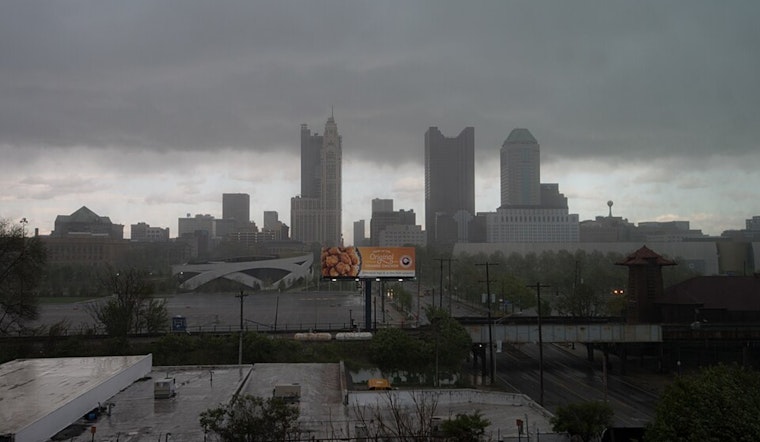
Forecasters at the National Weather Service in Wilmington have provided an update for the weather over Columbus, Cincinnati, and surrounding areas. According to their latest report, a small low-pressure system will quickly pass south of the area today, which will be followed by a weak cold front sliding across the region tonight into Saturday. It's expected that high pressure will start to dominate during the early part of next week, bringing more settled conditions.
The immediate forecast indicates that this morning and early afternoon will see showers, particularly along and south of the I-70 corridor. Moderate rain is projected "near and south of the Ohio River," according to the National Weather Service Wilmington OH. Columbus may experience unstable weather conditions that can lead to convection later in the day, primarily along and south of I-71 during the mid-to-late afternoon.
Temperatures will be a mixed bag, varying from mid-60s in the northeast of Kentucky and south central Ohio to the lower 70s in west central Ohio. As the evening sets in, an additional, weaker wave will drop across the region, triggering more showers and the possibility of thunderstorms. Instances of isolated showers may linger into Saturday as remnants of the cold front could provide a focal point for them.
Looking towards the latter half of the weekend and onward, there's a consensus for a cooler touch with a broad trough sticking through the state. "Lobes of PVA diving southward out of Canada will keep the troughing structure intact through the remainder of the weekend," notes the NWS forecast discussion. Highs will struggle to reach the 70s, trailing average norms by about 5 to 10 degrees. However, it's anticipated that the start of the work week will usher back the warmth as the trough moves east and a longwave ridge starts to settle in.
Aviation-wise, expect showers to affect flight conditions at regional airports early on, with varying visibility issues, notably at Cincinnati terminals, where even short-term IFR visibility restrictions could pop up. Shower activity may cause further interruptions in the afternoon, but skies should clear up quickly after the passage of the second weather disturbance tonight. Yet, Columbus might have to temporarily steel itself for potential MVFR ceilings in the wake of these systems.


