Residents in Washington D.C. are bracing themselves for a mix of hazardous weather conditions today, including the possibility of scattered showers and thunderstorms that could manifest after 5 pm. Foggy conditions are likely to continue to roll out as the day progresses with visibility limited to about four miles earlier this morning. Meteorologists are expecting a fairly warm day with highs nearing 80 degrees, alongside calm and variable winds shifting southwest, as per the latest update from the National Weather Service (NWS).
The upcoming night may also bring a slight chance of showers and thunderstorms before 2 am, expanding to a higher chance of sporadic showers past the early hours. Officials caution the public to remain prepared; patchy fog may make an appearance again after 4 am. The unsettled weather pattern is due to prolong, featuring a 50% chance of showers and thunderstorms well into Friday afternoon. According to forecasts from the NWS, come Friday night, there's yet a 40% chance to see some of these thunderstorms.
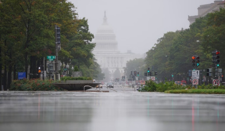
Amidst the erratic weather, a Coastal Flood Warning remains firmly in place until 4 PM EDT Friday, specifically for low lying areas within the District of Columbia, including Georgetown. The warning anticipates "Two to three feet of inundation above ground level expected in low lying areas due to freshwater flooding," and moderate flooding is expected. The impacts of the flooding are set to cover The Washington Harbour boardwalk, flood areas near Fletcher's Boathouse, and submerge parts of Roosevelt Island, while Rock Creek is expected to experience backwater flooding, as detailed by NWS.
For those navigating water routes, the NWS outlines high tides at 10:24 AM and again at 11:10 PM today, with a recommendation to take necessary actions to protect flood-prone property and to avoid driving through water of unknown depth. The situation continues to develop, and vigilant residents should take heed to not only prepare for the chance of flood but also to possibly engage with spotter activation as severe weather may require additional community reporting. Evolving forecasts indicate that the latter part of the week doesn't seem to promise much relief; Friday through Saturday, residents must yet again ready themselves for severe thunderstorms capable of delivering damaging winds and hail, though the precise timing remains uncertain.


