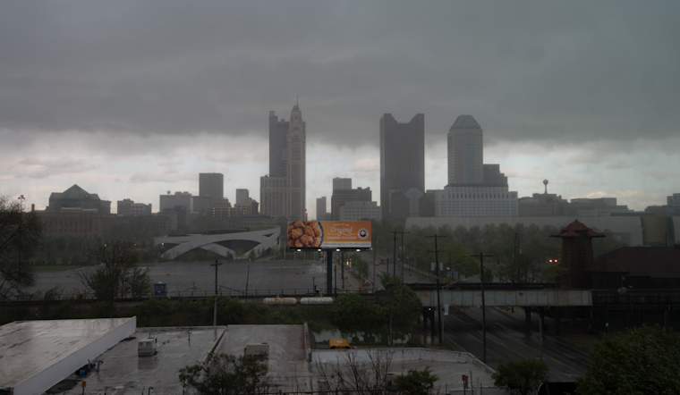
As the residents of Columbus, Cincinnati, and the surrounding areas brace for a bout of unpredictable weather, the National Weather Service in Wilmington serves as a critical lookout. A slow-moving front is expected to weave through the region today, maintaining the possibility of isolated showers and thunderstorms into the daylight hours, according to the NWS discussion. Seasonably warm and humid conditions will prevail until a shift occurs after Monday, with drier air expected to move in and remain in place until approximately Thursday.
Early risers and commuters faced pockets of heavy rain this morning, with areas to the south and west particularly prone, as reported by the National Weather Service. The compromised conditions, due to the saturated profile and weak, but persistent, instability, were a reminder that nature's whims often pay no heed to our schedules—flooding at night can be perilous. The service's advice, caught drifting through the airwaves and echoing in closed windows, was clear: "If you encounter high water in your vehicle, TURN AROUND."
The procession of clouds and rain is expected to relent somewhat as the day progresses. By late afternoon, the departing system promises to bow out, allowing for a clearer trend to emerge from west to east. In the wake's wake, a breeze is anticipated, with northwest winds reaching 12-15 knots and potential gusts around 20 knots, particularly in the western and southern parts of the forecast area.
As one weather saga closes, another looms on the horizon with the arrival of a more structured system on Monday. This fresh front presents a contrasting scenario, marked by an abrupt intensification in atmospheric dynamics. It's set to thrust a fresh band of showers with embedded thunderstorms into the area come Monday afternoon. "The best chance for some diurnally-driven destabilization to be realized on Monday is going to be near/E of I-71," notes the NWS forecast, pointing toward a potentially breezy reprisal of weather drama.
Ahead, though, the outlook from Monday night through Saturday maintains a seesaw of expectations. Frame by frame, the forecast narrative tells of cooler plunges into the upper 50s and a resurgence to the mid 80s, while skies wrestle with cloud cover and wrestle away sweeping fronts. Variances in models hint at weekend precipitation, yet consensus remains on hold, as though the weather itself ponders its next move.


