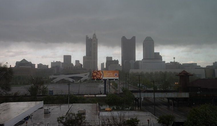
Residents across Columbus, Cincinnati, Wilmington, and beyond should expect a mix of storm clouds and showers with a side of humidity until early next week, as reported by the National Weather Service in Wilmington. According to the NWS report, a slow-moving front, stubborn as Ohio traffic, is set to stall across the area into early Saturday, bringing several rounds of showers and storms.
While Friday might gift us with a break in the clouds, a weak surface wave is projected to keep isolated to scattered showers and thunderstorms rolling well past sunset. In the game of atmospheric impulses, there's a mild and muggy night in store for tonight as temperatures only dip into the mid to upper 60s, NWS predicts. Daybreak on Friday should see readings bounce back into the comfortable zone of upper 70s and lower 80s.
Over the weekend, another shortwave is expected to extend our dates with thunderstorm activity into early Sunday, which might bring some fireworks to our evening plans. However, the main event seems to be lined up for Friday night when stronger activity could dance across the skyline. As if nature's light show wasn't enough, "a lingering strong/severe storm is possible" in the Ohio River area, says NWS.
Looking further out, we've got higher confidence in drier times ahead as a trough on Tuesday sets the stage for potentially calmer conditions by midweek. As for temperatures, we're circling around normal, with neither scorching highs nor chilling lows on the cards—just enough variability to keep your wardrobe guessing. "Temperatures over the period are near to slightly below normal," the NWS explains, marking a pause from potential extreme weather drama.
For those with wings, the aviation outlook is a bit bumpy. VFR conditions are expected to prevail, but incoming batches of rain and thunderstorms might result in occasional dips into MVFR/IFR visibility—pilots should stay familiar with their instruments. "VFR conditions will prevail as cloud cover thickens and overspreads from the W through the morning hours," the aviation section of the NWS forecast states, painting a stable background before storms potentially darken the gates.


