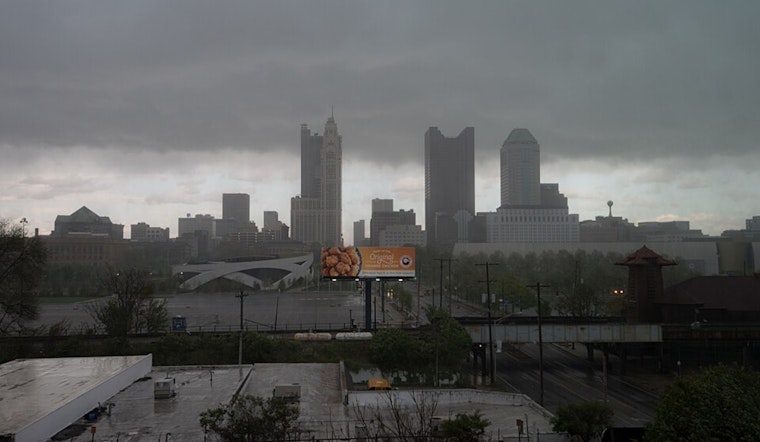
The National Weather Service in Wilmington, Ohio has forecast a pattern of periodic showers and potential thunderstorms across Columbus, Cincinnati, and Wilmington regions. According to their recent report, a nearly stationary frontal boundary, coupled with a sluggish upper-level energy flow, will contribute to the wet conditions over the next several days. Temperatures are expected to hover near or just below normal this weekend, with a warming trend on the horizon as we head into the middle of the upcoming week.
For Saturday, a change from Friday's conditions was noted, as the surface boundary slightly shifted southward into the forecast area. However, a weakening upper trough moving eastward may lead to a reduced chance of precipitation compared to Friday. Areas near and south of the surface boundary, which is expected to settle toward the Ohio River by late afternoon, might see concentrated thunderstorm activity. "Thunderstorms should be mostly isolated, with scattered rumbles of thunder more focused along/south of the boundary through the day," the National Weather Service explained. Temperatures are set to stay mild, ranging from the mid-70s in the far north to the upper 70s or even touching 80 along and south of the I70 corridor.
As evening sets in and the boundary dips further south past the Ohio River, diminishing instability will translate to a downscaled chance of precipitation, largely confined to south-central Ohio and northeast Kentucky. Conditions are expected to stabilize overnight, with lows in the low 60s up north to upper 60s down south. For Sunday, the residue of the upper trough will still influence weather patterns, mainly initiating showery activity and ushering in isolated thunderstorms in response to daytime heating and instability. High temperatures on Sunday will skirt the upper 70s and lower 80s, with sticky dewpoints close to the 70-degree mark.
Looking ahead, the regional weather pattern is predicted to shift early next week, as described by the National Weather Service's long-term outlook. The week promises "a more progressive scenario," with a southwesterly flow bringing increased heat and humidity through to Wednesday, which may see highs in the mid to upper 80s and even higher heat indices. Some severe weather threats could develop with this change, particularly around peak daytime hours. The midweek could herald a more significant storm potential, "possibly including the ILN forecast area," according to the National Weather Service. Predictions from Thursday onward are less definite, with some discrepancies in the movement of a wave and an associated cold front.
Travelers and outdoor planners, take note: aviation interests should stay alert for possible MVFR to IFR conditions tied to the stormy weather expected Sunday through Wednesday. The NWS advises that if you'd like detailed updates on the evolving conditions, stay tuned to their communications, especially concerning storm development over the coming days.


