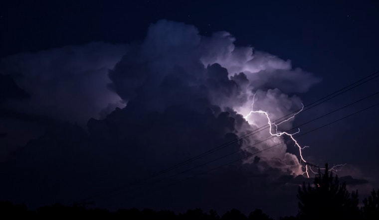
The National Weather Service in Raleigh has issued a Hazardous Weather Outlook for central North Carolina, forecasting a chance of strong to severe storms capable of producing damaging wind gusts later this afternoon and evening, with the possibility of a few lingering overnight, according to the latest update by the NWS.
Residents in the areas of Person, Granville, Vance, and other parts of central North Carolina should brace for a tempestuous week with the weather patterns taking a disruptive swing; scattered showers and storms are on tap for Tuesday, which could escalate into severe territory and even drench certain locales with isolated heavy rainfall, as per the Hazardous Weather Outlook by the NWS.
In terms of temperatures, the Raleigh area is set for a sweltering week, with today's high creeping near a sultry 90 degrees and a light wind shifting from west to southwest as the day rolls on; tonight, chances of showers and thunderstorms increase after midnight, topping off a day that begins mostly sunny.
Looking ahead to Tuesday, the likelihood of showers and thunderstorms rises after 2pm, while breaks in clouds on Wednesday afford mostly sunny skies, calming the weather's recent ferocity, and that follows into Thursday with temperatures forecast to hover near 91 degrees, according to the NWS.
The pattern of intermittent storms seems to bookmark the late hours of the week as well, with a 40% chance of showers and thunderstorms after 2pm on Friday, and the cycle repeating through the weekend; "spotter activation may be needed," the Hazardous Weather Outlook notes, suggesting the potential for significant weather events that warrant close observation.


