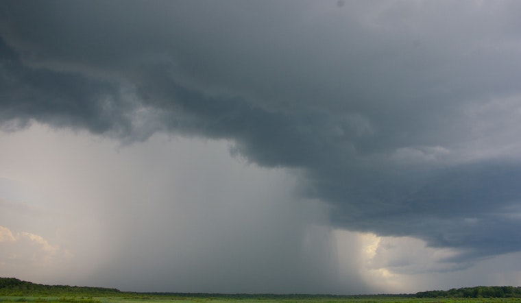
Houston residents, preparing for a potentially indoor-focused weekend, are bracing for significant rainfall and possible flooding. The National Weather Service forecasts widespread showers and thunderstorms—mainly after 1 p.m. today—with heavy rain expected through tomorrow as a Gulf system moves inland. Highs will reach near 90 degrees, accompanied by an 80% chance of precipitation, which could bring between half an inch and three-quarters of an inch of new rainfall.
Meanwhile, CW39 indicates localized flooding is a threat, particularly in low-lying or poorly drained areas due to storms; rainfall totals could range from 1/4 to 2.5 inches, and the Houston area is under a Marginal Risk for excessive rainfall, meaning isolated flash flooding is possible and rainfall totals of 1 to 2 inches are expected with the chance for even higher amounts in certain zones.
Tonight is shaping up to be particularly wet, with continued heavy showers and possible thunderstorms before tapering off tomorrow evening. CW39 suggests commuters exercise caution, be watchful for flooded streets, and avoid waterlogged roads. A respite from the recent heatwave is the silver lining, with temperatures forecasted to dip slightly; they will remain in the low 90s but will feel like they're in the range of 100–103 degrees this afternoon.
Looking ahead to the rest of the weekend and the coming week, the forecast reveals a mix of cloudy skies and sunshine, with temperatures reaching into the mid-90s and chances of showers and thunderstorms sporadically dotting the Houstonian landscape. The weekend concludes with a slightly cooler, partly cloudy Sunday night, with lows around 78 degrees expected to persist.


