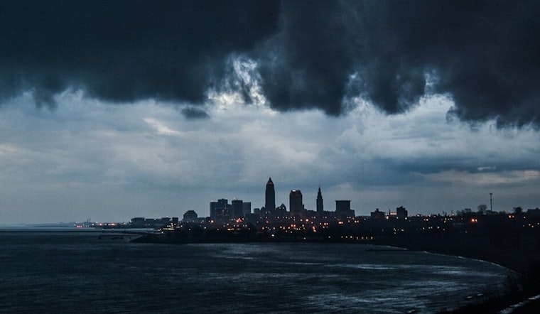
As the Bay Area basks in its typical summer climate, folks in Ohio are bracing for a variety of weather activities, including potential isolated flash flooding and thunderstorms, according to the National Weather Service in Cleveland. NWS Cleveland predicts that weak high pressure will offer a brief respite today before making way for a warm front to lift across the region later into the night and into Wednesday morning.
Residents, especially in urbanized corridors like Cleveland-Akron-Canton-Youngstown, should prepare for "substantial moisture" and the possibility of efficient, heavy rainfall which could lead to localized flash flooding; showers and thunderstorms are expected to expand on Wednesday afternoon, especially "east of a Sandusky-Marion line," with the NWS warning of PoPs in the 70-80% range for the area. The NWS also highlighted a "slight risk for Excessive Rainfall" due to conditions which are above climatological max values for mid-July, and a compact shortwave trough following the warm front that will further help storm formation through "forcing from the trough."
By Wednesday evening, the primary catalysts for storm activity should move on, but the area isn't out of the woods yet—the National Weather Service also anticipates another round of showers and thunderstorms on Thursday with the arrival of an upper-level trough, which might bring another "low end risk for severe weather and localized flash flooding." Following this, a cold front is expected to bring cooler temperatures, highs in the upper 70s, promising "good bonfire weather" for Friday night.
The marine outlook for Lake Erie indicates relatively calm conditions for now, with winds staying under 10 knots and waves less than 2 feet—a cold front is expected to increase winds around 15 knots out of the southwest by the end of the week, potentially causing increased wave heights during widespread thunderstorms; safety for boaters is a concern due to possible stronger wind gusts and higher waves brought on by the storms.
Looking ahead to the weekend and the beginning of next week, forecasts suggest that the cool weather will not last, with scattered showers and thunderstorms anticipated to return on Saturday evening, continuing into Sunday as a weak low crosses the Great Lakes region. This is subject to change, though, given the week-ahead forecast in July, residents should stay tuned to the NWS updates for the latest weather information as the week progresses.


.jpg)