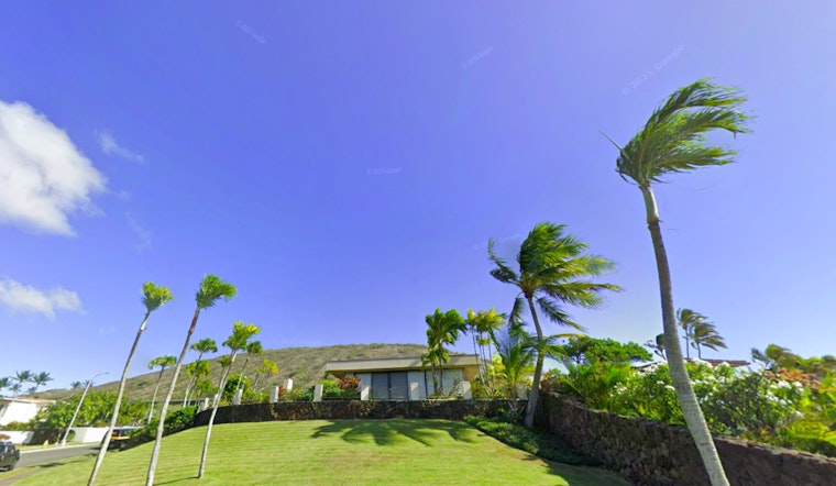
Honolulu is bracing for strong trades and the potential aftermath of Tropical Cyclone Gil later this week, but in the immediate term, residents are dealing with high winds and dry conditions. According to the National Weather Service in Honolulu, breezy to windy trade winds will persist throughout the day before diminishing by early Monday. While the windward and mauka regions may experience light precipitation, leeward areas are expected to remain dry, exacerbating ongoing drought conditions.
An active Wind Advisory remains effective until 6 PM HST for multiple regions. The advisory, which details sustained winds of 30-plus mph with gusts topping 50 mph in certain areas, warns citizens to be cautious of potential hazards. "Gusty winds can fall small trees or break tree branches so take heed if outside near or under larger trees," the NWS report indicates. Furthermore, there's a Red Flag Warning in place due to the combination of gusty winds and low humidity, potentially fueling critical fire weather conditions.
Marine conditions also face the brunt of the strong trade winds with a Small Craft Advisory extended through the evening for all coastal zones. As Tropical Storm Gil weakens to a depression, forecasters expect the trade winds to moderate but caution that the remnants of the storm could disrupt trade flow and increase rain chances statewide later in the week.
Surfers will also note diminishing surf along south and east-facing shores before another south swell rises early Monday. The NWS is watching a swell, possibly hitting High Surf Advisory criteria later in the week, formed from a low south of New Zealand with seas up to 40 feet. Meanwhile, a moderate, medium to long period east swell is expected from the energy of Tropical System Gil, "expected to fill in by late Monday into Tuesday," according to the NWS forecast.
Looking ahead, while breezy trade winds and dry conditions will dominate the early part of the week, the remnants of Tropical Cyclone Gil may introduce increased moisture and shower activity, potentially offering some respite to the drought-stricken regions. Nonetheless, the NWS anticipates that the heaviest moisture will likely remain north of Hawaii, with a local uptick in showers largely projected for the windward communities.


