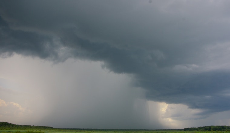
Houston residents are bracing for another round of heavy showers this afternoon, with a FOX 26 Storm Alert in effect from 2 to 9 p.m., bringing scattered, significant rainfall and high humidity levels. Following the atmospheric conditions that led to more than 3" of rain in Fort Bend County yesterday, meteorologists are directing locals to stay informed through updates on local news and weather apps.
According to the National Weather Service, Houston is likely to see showers and thunderstorms mainly after 1 p.m. today, with a 60% chance of precipitation and new rainfall amounts potentially exceeding a quarter of an inch, especially in thunderstorms. The city will experience mostly cloudy skies, with a high temperature peaking near 90 degrees and a north wind around 5 mph. Tonight's forecast continues with a 40% chance of additional showers and thunderstorms, chiefly after 1 a.m., and mostly cloudy conditions maintaining a low around 76 degrees.
The weekend outlook promises partial relief, with mixed predictions for tomorrow suggesting at least scattered showers and a few storms, particularly south of Houston. Moving beyond the weekend, Houstonians can anticipate higher temperatures, reaching mid to upper 90s on Sunday and isolated rain chances.
Meanwhile, the tropics are active with Hurricane Erin transitioning to an "extra-tropical" system as it advances away from the U.S. East Coast, poised to affect the North Atlantic with wind and rain. Another tropical wave is being monitored as it advances toward the Caribbean, though models currently do not indicate significant development, the pattern is one to watch in the extended term, as reported by FOX 26.


