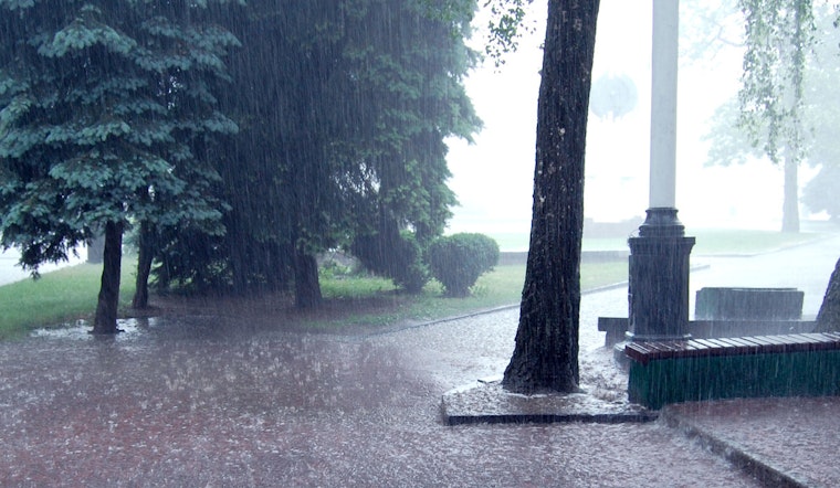
Houston is facing another spell of precarious weather, with forecasts predicting showers and thunderstorms likely to persist through the end of the week. According to a report from the National Weather Service, the city can expect isolated thunderstorms to be more likely after 4 p.m. today, with high temperatures nearing 94 degrees and heat index values up to 103. Winds will shift from north to northeast in the afternoon, while the chance of precipitation holds at 60%.
The nighttime will not bring much relief, with storms and showers predicted mainly before 10 p.m., leading to a mostly cloudy evening and a low temperature of around 78 degrees. Houston residents have been advised to remain alert to the possibility of rainfall between a quarter and a half-inch, particularly during thunderstorms. The National Weather Service cautions that new rainfall could contribute to potential flooding concerns, a risk that stands at 1 on a 4-point scale, implying a lower threat but not one to totally disregard.
Tomorrow, the likelihood of precipitation rises to 80%, with showers and possible thunderstorms forecasted throughout the day. Citizens can anticipate reduced temperatures, with the high near 89 degrees, thanks to expected widespread rain and cloud coverage, as mentioned in a Click2Houston report. However, the weekend suggests a return to the typical swelter of Houston summers, with a lesser chance of rain and high temperatures holding steady in the mid-90s.
Meanwhile, meteorologists are closely tracking the development of hurricanes in the Atlantic. Tropical Storm Erin has already warranted warnings along the East Coast, with the anticipation of storm surges reaching 2 to 4 feet. While Houston is not directly in the path, the presence of these tropical systems indicates an active hurricane pattern within the region. Another disturbance has a 70 percent chance to strengthen into Tropical Storm Fernand over the next two days, but current models predict a course veering towards Bermuda. Even as these systems steer clear of Houston, local authorities suggest residents to stay informed and prepared, with resources available through the 2025 Hurricane and Flood Survival Guide provided by Click2Houston.


