As Jacksonville braces for a mix of sunny skies and turbulent weather, the National Weather Service (NWS) in Jacksonville, FL, has issued a High Surf Advisory and High Rip Current Risk alert effective through the weekend. The forecast promises a mostly sunny today, with a high near 82 and northeast winds gusting as high as 20 mph. However, this calm is poised to break, with increasing wind speeds and a rising chance of showers and thunderstorms in the coming days.
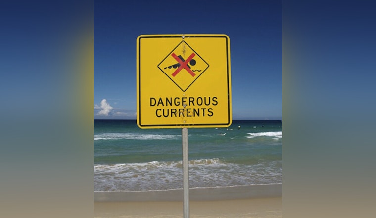
Starting tonight, residents are expected to experience partly cloudy skies and lows around 72 degrees. The winds are predicted to steadily pick up, potentially introducing dangerous swimming conditions along Southeast Georgia beaches. According to the Rip Current Statement by the NWS, "For the High Surf Advisory, large breaking waves of 7 to 10 feet" are expected, alongside "dangerous rip currents." These conditions are set to persist until 5 AM EDT Sunday, with the high rip current risk extending through late Saturday night.
The Rip Current Statement cautions that such conditions could lead to "localized beach erosion" in addition to making aquatic activities perilous. They strongly advise against inexperienced swimmers entering the water, underscoring the power of rip currents to "sweep even the best swimmers away from shore into deeper water." As the weather intensifies, safety becomes paramount for those near the coastline.
For those undeterred by the gusting winds and expected to venture out, the NWS' Rip Current Statement advises to "Swim near a lifeguard" and, if caught in a rip current, to "relax and float" rather than swim against the force of the current. If possible, they should swim in a direction that follows the shoreline or, if unable to escape, "face the shore and call or wave for help." With precipitation chances increasing to 70% by Sunday and conditions anticipated to remain hazardous, keeping safety in mind could not be more critical.


