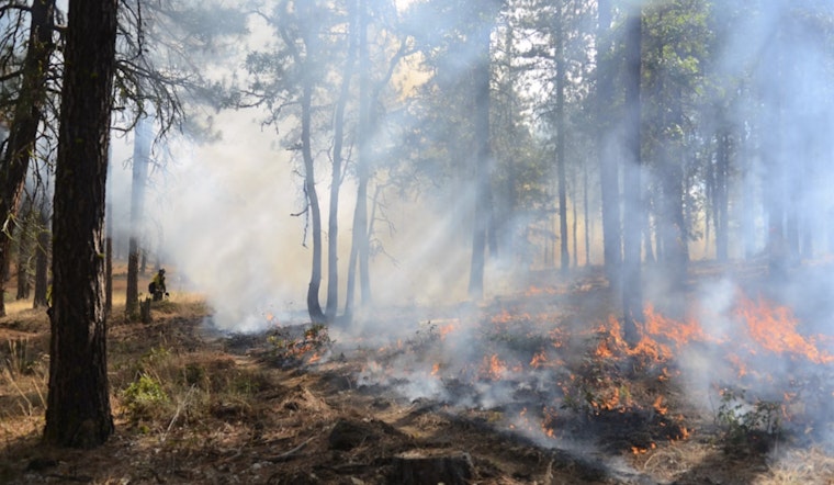
Residents and visitors in the Coconino National Forest area should anticipate prescribed burns scheduled to commence next week. According to the Arizona Emergency Information Network, Coconino National Forest officials have announced a series of controlled fire operations aimed at reducing overgrowth and shielding communities, infrastructure, and natural resources from wildfires.
The burns will start on Tuesday and are set to proceed throughout the week, as long as weather conditions are favorable. Areas targeted for these fire management efforts include a 1,400-acre plot near Campbell Mesa, an 11,500-acre area near Upper Beaver Creek, and a 10-acre section within the Crescent Moon Ranch area. While these prescribed burns are routine, they are essential for landscape and community protection, according to the Coconino National Forest statement.
Timing for the burns is as follows: The Campbell Mesa project is planned for Nov. 11-13, and is located 5 miles east of downtown Flagstaff. The Upper Beaver Creek project will take place between Nov. 12-14, approximately 16.5 miles southeast of Sedona. And the Crescent Moon Admin Pile project is set for Nov. 12, just 1.5 miles south of Sedona Airport. Motorists in these areas should watch for warning signs and be prepared for reduced visibility during the burns.
Residents in proximity to the burns may encounter smoke and are advised to check the AirNow website for air quality information. If driving near the burn areas, slowing down and using headlights is recommended upon encountering smoke. It's worth noting, weather conditions are closely monitored leading up to the burns; if conditions change, the prescribed burn activities may be adjusted or canceled.
For up-to-date information on the prescribed burns in Coconino National Forest, the public can refer to InciWeb, the interagency incident information system. The prescribed burn strategy is a proactive measure to manage land and minimize the risk of uncontrolled wildfires that could threaten the region.


