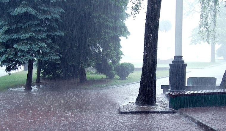
Residents in Sacramento should prepare for a wet and blustery day as the National Weather Service forecasts showery conditions to persist, accompanied by the possibility of thunderstorms later this morning. With the chance of precipitation fixed at a solid 100%, those in the area can expect "new rainfall amounts between 1 and 2 inches possible," as stated in the latest update issued earlier today. Driving through the heavy downpours could prove challenging with gusts potentially reaching as high as 32 mph.
The soggy weather is set to continue into the evening, though with a reduced likelihood of showers before it heads toward midnight. The NWS warns that becoming mostly cloudy, Sacramento will experience a dip in temperature to a low around 54 degrees, and while the south wind is expected to calm to a mere 5 to 7 mph, commuters driving home after a long day might still face some residual gusts.
Breaking through the clouds, tomorrow may offer a glimpse of respite; albeit, a 30 percent chance of showers remains in the forecast before 10am. According to the NWS, the skies are "mostly cloudy, then gradually becoming sunny," with a daytime high teetering once more near 64 degrees. For those planning weekend activities, it's worth noting that a light wind is on the agenda, expected to swing north-northwest around 5 mph in the morning.
Partly cloudy skies are in the offing for tomorrow night as the sun makes its retreat, leaving behind an anticipated low around 50 degrees. Residents enjoying the evening outdoors will grace a light north-northwest breeze, blowing at a tender pace of 3 to 5 mph. Saturday aims to mirror the previous days with a sneaky 20 percent chance of showers peeking around the corner post-10am, and temperatures clutching to the mid-60s.
As Saturday night unfolds, the likelihood of showers inches up to 40 percent amidst mostly cloudy conditions. The NWS has forecasted a low hovering near 53 degrees, suggesting that those planning to be out may want to keep their umbrellas within arm's reach. The unsettled pattern is expected to continue into Sunday with a day similar to its predecessor, marked by primarily cloudy skies, a steady high around 60 degrees, and persistent chances of rain.
Looking ahead to the onset of the new week, the prospect of showers maintains a lingering presence, with partly sunny weather making an intermittent appearance. By Monday night, the odds of precipitation dwindle, culminating in a clearer Tuesday, when the region might finally witness a mostly sunny day. The forecast provided by the NWS for Wednesday subtly hints at a return to the slight chance of showers, rounding off a week that seems to dance between the droplets and the dry.


