Strong tradewinds and a northeast swell are affecting parts of the state. A Wind Advisory is in effect for parts of Maui County and the Big Island on Thursday until 6 a.m., and a High Surf Advisory is in effect for east-facing shores on Thursday until 6 p.m. Officials warn of dangerous surf, coastal flooding, and gusty winds that could cause property damage and power outages.
High surf advisory extended for east-facing shores
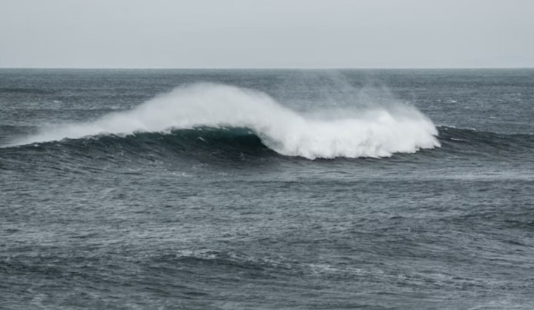
Kauaʻi Now reports the High Surf Advisory runs through 6 p.m. on Thursday for east-facing shores of Kaua‘i, Oʻahu, Molokaʻi, Maui, and Hawaiʻi Island, with surf building into the 10–14 foot range. Hawaii News Now adds that higher-than-predicted tide levels, paired with strong onshore winds, could drive significant wave runup, beach erosion, and pockets of coastal flooding. Large breaking waves may wash across normally dry parts of beaches and roads, so heed ocean-safety warnings.
Wind advisory covers portions of Maui County and the Big Island
A Wind Advisory remains up for parts of Maui County and Hawaiʻi Island until 6 a.m. on Thursday, with sustained northeast winds of 25–35 mph and gusts that could top 55 mph in exposed saddles and passes. Big Island Now notes the strongest winds will funnel through terrain features and near inter-island channels, raising the risk of downed branches and damage to unsecured structures. High-profile vehicles will be tough to handle in the worst gusts, and power outages are possible.
Closures and power watch
High surf already forced closures of multiple Hilo beach parks and prompted a temporary shutdown of Bayfront Highway after waves and debris made the roadway unsafe, county officials said. Hawaii News Now says oceanfront residents and boat owners should secure their vessels and be prepared for possible overwash at ramps and harbor entrances. Hawaiian Electric says it is monitoring conditions on Hawaiʻi Island and may carry out Public Safety Power Shutoffs in certain high-risk areas if gusty winds and dry fuels increase wildfire risks.
What residents should do now
Ocean-safety officials urge people to stay off the water and keep a safe distance from the surfline on affected east shores—especially during high tides, when overwash risk spikes. Local guidance from forecasters recommends securing outdoor furniture and valuables, planning for short-term power interruptions, and moving vehicles to higher ground when practical. Mariners and small‑craft operators should follow marine advisories and hold off on launching until seas relax.
What’s driving the pattern
Forecasters point to robust high pressure north of the chain tightening the pressure gradient, which is revving up the trades while a northeast swell energizes east‑facing beaches. Area forecast discussions echoed by local outlets describe trades funneling through channels and passes—meaning gusty conditions and elevated seas should gradually ease after Thursday as the high shifts east. Keep an eye on updates; a subtle shift in swell direction or wind strength can be the difference between advisory‑level surf and a calmer lineup.
For near‑real‑time updates, check the Hawaii Emergency Management Agency and the National Weather Service in Honolulu, and follow local reporting on closures and safety notices. See the Hawaii EMA advisory and local forecasts from HNN and Big Island Now for the latest information.
WIND ADVISORY
— Hawaii EMA (@Hawaii_EMA) November 12, 2025
for the portions of MAUI COUNTY and THE BIG ISLAND until 6 AM HST Thursday (10/13).
HIGH SURF ADVISORY EXTENDED
for the East facing shores of Kauai, Oahu, Molokai, Maui, and the Big Island until 6 PM HST Thursday (11/13).


