Baltimore is bracing for a mix of meteorological events as the National Weather Service has forecast a surge in temperatures followed by a strong cold front. According to the latest report, high pressure near the Delmarva is expected to retreat, with milder weather and dry conditions expected to continue through Thursday. Locals can enjoy moderate temperatures before a more turbulent shift in weather late in the week.
With a weak dry cold front sliding across the region today, residents should be hardly noticing a shift outside of a brief change in wind direction. A second high pressure building in until Thursday promises a slight temperature climb, with highs reaching the middle to upper 40s in the north and lower to middle 50s further south. Wet conditions are on the radar for Thursday afternoon through the evening as a warm front moves northward from southern Virginia and across areas in north-central North Carolina. Already by Thursday afternoon, pre-frontal rain showers may grace the region, setting the stage for heavier showers and a possible few thunderstorms come evening.
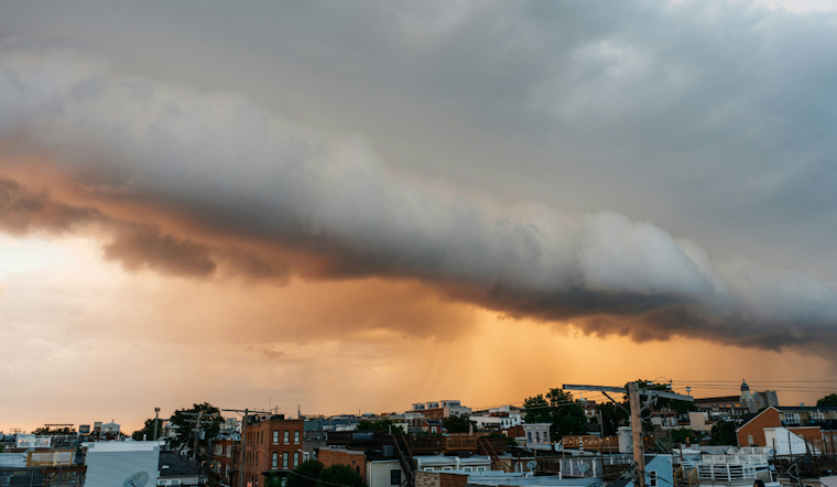
The National Weather Service cautions that "showers are expected to develop ahead of a powerful cold front" during late Thursday evening stretching into the wee hours of Friday morning. This impending cold front is bringing with it the prospect of gusty showers and some thunderstorm activity. While the presence of significant wind shear raises concerns for severe weather, the likelihood of this remains mitigated due to low instability predicted, particularly given the overnight timing of the front's passage.
Following the frontal turbulence, Friday is set to bring back cold and windy weather. An upper trough will swing through the area early Friday accompanied by a low-level jet stream, possibly generating gusts ranging from 35 to 45 mph. Areas north of the I-66 corridor and the higher elevations could face stronger winds, prompting potential wind advisories. Residents should prepare for a blustery Friday, with a slight reprieve expected as high pressure returns over the weekend, signaling drier and more seasonal conditions for the area.
In the aviation sector, travelers may encounter some delays with the possibility of Sub-VFR conditions and gusty winds, particularly on Friday following the cold front. The National Weather Service has flagged the potential for crosswinds and turbulence affecting flights, advising caution for pilots and passengers alike. As the forecast progresses into the weekend, they're expecting VFR conditions to make a return with high pressure in control.
Mariners should also take heed, with a Small Craft Advisory already issued due to southerly channeling over the Chesapeake Bay and tidal Potomac. That advisory remains in effect through early Thursday, but conditions are likely to intensify leading up to and following the cold front. Winds could ramp up to Gale-force on Friday, easing off by Saturday as the high pressure takes the helm once again.


