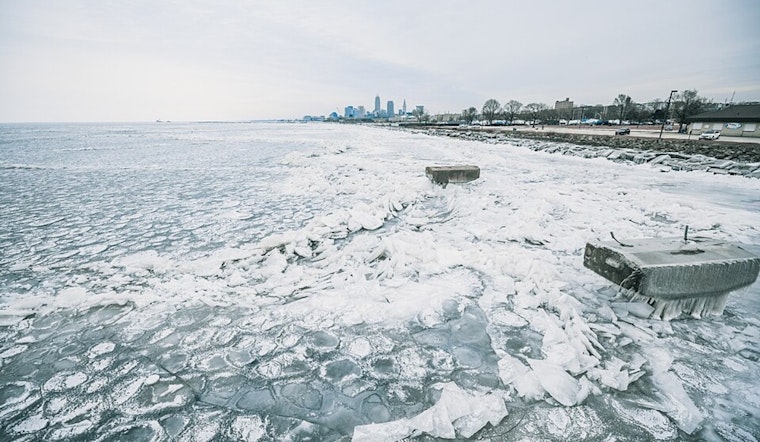
Cleveland residents, brace yourselves for the coldest temperatures of the winter season thus far. An Arctic cold front has made its grand entrance early this morning, setting the scene for a remarkably brisk Thursday and Friday. According to the National Weather Service in Cleveland, temperatures won't breach the mid-20s today, and wind chills will have us wrapped in the icy embrace of single digits to teens later in the day. There might also be a "burst of light snow" as the front blows through, with some lake effect snow showers expected, primarily in the snowbelt areas where a potential 1 to 3 inches can accumulate, NWS reports.
Friday morning is set to greet Northeast Ohioans with single-digit temperatures, so be prepared to bundle up. Adding to the meteorological playlist, high pressure is anticipated to rock steady in the region, bringing clearer skies and thus, "Friday with partly cloudy skies and afternoon temperatures in the upper 20s to lower 30s," per NWS. Although winds are expected to calm down overnight, any lingering breeze will be enough to make the wind chills stay uncomfortably close, or even below zero.
Looking ahead to the weekend, don't expect a major thaw. The NWS Cleveland's discussion underscores that a "large upper level trough" will maintain the chill over the Great Lakes region, with another cold front planned to roll through on Sunday. Saturday may give respite with slight moderation in temperatures, but light snow could mark the days from Saturday to Sunday, with possible minor accumulations in the snowbelt areas.
As we sail into next week, the forecast holds a very "Monday will be very cold in the middle to upper 20s" note, keeping spirits cool if not frozen. Prepare to greet early Monday with single-digit to teen wind chills, although the atmospheric tune might shift slightly milder as we head into midweek with temperatures slated to return to the 30s, but not without another round of light snow and a cold frontal passage by Wednesday. All this translates to some "lingering lake effect snow showers early Monday across the Snowbelt" and a strong hint of déjà vu entering the scene, once again, as a potent reminder of the season’s grip on the region, as parsed out by the NWS Cleveland forecast. Mariners and aviators alike, take note: Improved conditions on the lake are fleeting, with the potential for rough waters returning late Sunday into Monday and again on Tuesday.


.jpg)