Clevelanders can expect the calm before the flurry this weekend as high pressure reigns supreme today before a quick-moving weather system sends temperatures plummeting and light snow flurries across the region. The National Weather Service in Cleveland reports that while today will be relatively quiescent with highs struggling to reach the freezing mark, a clipper system is anticipated to scoot through on Sunday, with potential snow accumulations of 1 to 2 inches for northern Ohio and northwest Pennsylvania.
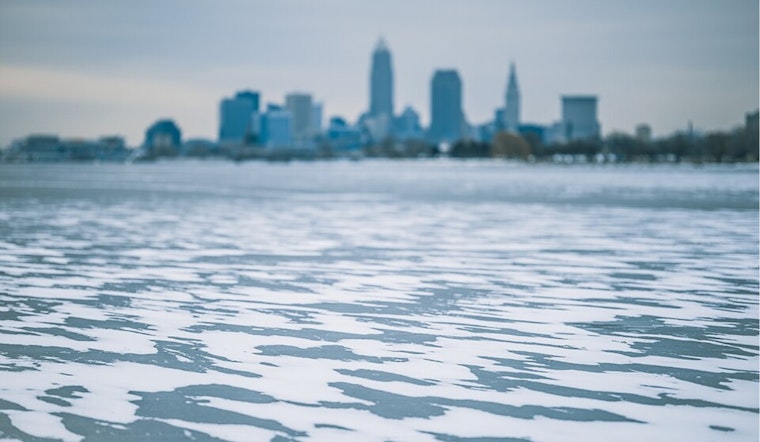
For those getting a jump on the weekend, Saturday might bring a modest increase in the southwesterly breeze and, with it, some light snow, particularly to those north and east of Cleveland. The forecast points out that "Any snowfall will be light from a dusting to maybe 1 inch." Meanwhile, significant ice formation has been spotted on Lake Erie, suggesting that winter has firmly laid its cold hand upon the Great Lakes region.
Come Sunday, a fresh clipper system dives through the Midwest, tugging along a cold front and a promise of light snow. Following this system, Sunday evening could intensify flurries with an additional 1 to 2 inches of accumulation in the Snowbelt. The NWS Cleveland briefing indicates colder air will follow on the heels of these systems, stating, "High temperatures on Sunday will be in the lower to middle 30s with temps slowly falling later in the day."
Next week doesn’t look any warmer as the NWS anticipates a continuation of the colder-than-average and active weather pattern. By Tuesday and Wednesday, temperatures might nudge slightly higher, hovering around 40 degrees before another shortwave trough potentially brings a mix of rain and snow midweek. Marine interests take note: initial ice buildup has been observed near Toledo's Maumee Bay and Sandusky Bay, serving as a stark reminder that winter shipping can quickly become a treacherous endeavor in these freshwater seas.
While residents bundle up and brace for the bite of near-record low temperatures this morning, historic cold is not quite rewriting the books yet. The records for December 5—some longstanding since the 19th century—might just stand another year, despite today's biting cold.


.jpg)