Cleveland residents, brace yourselves for a teeth-chattering start to the week. The National Weather Service in Cleveland has issued critical updates on the impending frigid weather that is slated to sweep across Northeast Ohio and Northwest Pennsylvania from Monday through Tuesday night. According to their latest forecast, we're looking at potential wind chills diving to sub-zero territories with a chilling -10F to -20F on the cards. As for snowfall, get ready for a lake effect snow event that could blanket parts of the region, particularly targeting the far Northeast Ohio and Northwest Pennsylvania lakeshores late Monday into Tuesday.
In a bid to keep the public promptly informed, the NWS highlights the main concern being the "frigid weather heading this way Monday through Tuesday night with dangerous cold wind chills as low as -10F to -20F possible." An arctic high-pressure system is expected to sweep in from the Midwest, building into the Ohio Valley and drastically pulling down the temperatures. Folks could be waking up to temperatures around zero or even below, with Monday’s highs barely making it into the teens. What's more, an Arctic front is due to arrive early Monday, causing temperatures to slowly fall throughout the day.
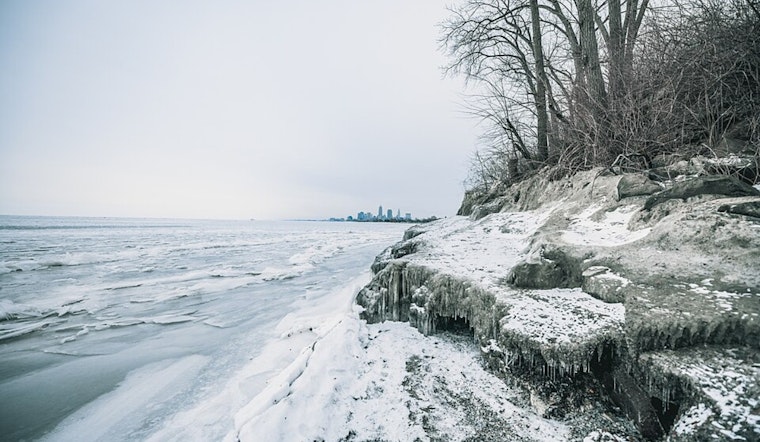
Furthermore, if you happen to be near Lake Erie, keep your eyes peeled – and not only because of the cold. It appears that lake effect snow may develop due to very cold southwesterly flow over the lake. The NWS has observed, "A lake effect snow event will develop with very cold southwesterly flow over Lake Erie late tonight through Tuesday evening." This is expected mainly to impact southwestern New York, but areas closer to Ashtabula County, OH, and Erie County, PA, may also see significant snowfall accumulations if the snow bands wobble closer as predicted.
And just to add a bit of variety to the week ahead, there are several waves of light snow showers in the forecast, stemming from fast-moving low-pressure systems cruising across the Great Lakes region. These could bring light snow and minor travel disruptions, particularly for commuters on Monday morning. To make sure you're fully abreast of this icy weather intrusion, visit the National Weather Service website for the most current updates and advisories.
For mariners, the forecast is decidedly rocky, with gale warnings and heavy freezing spray warnings active for Lake Erie. Winds could gust up to 45 knots, and significant ice drift is on the radar.


.jpg)