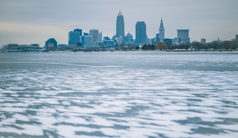
Residents of Cleveland and the surrounding areas can expect a wintry mix over the weekend, with a brief respite followed by warmer conditions early next week, according to the National Weather Service Cleveland OH. Saturday morning saw the end of flurries in the east with high level clouds moving in from the west. An incoming trough across the Great Lakes Region is forecasted to bring moisture back into the lower levels later in the day with snow expected to make a return by tonight.
Snow accumulation is anticipated to be between 1-3 inches in Northeast Ohio and Northwest Pennsylvania, specifically in the snowbelt region. Erie County, Pennsylvania, could see locally 2-4 inches. "Scattered snow showers are possible across northern portions of the area but accumulations will be confined primarily to the snowbelt region of Northeast Ohio, and Northwest Pennsylvania," the National Weather Service stated. Sunday's additional snowfall is expected to be lighter in Ohio, lingering more persistently in Northwest Pennsylvania with another 1-2 inches possible.
Going into Monday, high pressure will shift east and a warm front will lift north, bringing slight chances for snow in the far Northeast Ohio and Northwest Pennsylvania areas, though little accumulation is expected due to rising temperatures. Highs on Monday will rise to about 10 degrees warmer than Sunday, continuing to climb into the 40s across the region by Tuesday. Some scattered rain showers are possible Tuesday with 850mb temperatures reaching 4-6C, signaling a considerable warm-up from the weekend's colder snap.
In the extended forecast, Cleveland can prepare for well above normal temperatures for early January, rising into the 50s. This unusual warmth will likely result in snow melting across the region. "We will certainly expect to see rises on rivers in the snowbelt region for the end of the week, and may need to monitor flooding potential at a few locations," indicated the NWS forecast discussion. A full latitude trough advancing from the Plains promises to bring a round of rain and potential flooding concerns from Thursday night into the weekend.
For mariners, the Small Craft Advisories have expired, and no headlines are anticipated in the coming days. Winds will remain on the lighter side, shifting offshore Sunday night into Monday. However, boaters might need to anticipate advisories as south/southwest flows are expected to deepen by the coming weekend.


.jpg)