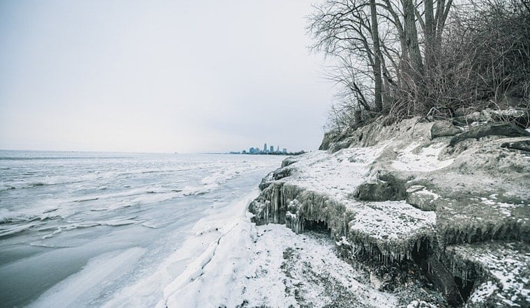
The city of Cleveland is bracing for a wave of frigid temperatures as the National Weather Service (NWS) Cleveland has issued a dire Cold Weather Advisory, warning residents of wind chill values plummeting to the bone-rattling range of -15 to -24F from 7 PM on Friday to 11 AM on Saturday, spanning the entirety of the forecast area, according to the latest from NWS Cleveland. With potential record lows poised to eclipse historic marks set over a century ago, the advisory paints a grim picture for both residents and local wildlife, urging all to minimize time outdoors and to don ample protective gear or face the wrath of the arctic chill.
The grip of the polar vortex promises little reprieve as persistent very cold weather is set to remain a stubborn guest through Sunday night, with nightly air temperatures forecasted to hover near or below zero degrees, even touching the -12F mark tonight which could set a new record for this date our infrastructure teeters on the brink as the extended freeze threatens to snap more than just the will of a winter-weary populace—with burst pipes and faltering car batteries standing testament to a cold's cruel capacity for chaos.
Light snowfall also peppers the advisory's concerns, bringing intermittent showers that might lead to minor travel irritations, particularly as any repetitive shower activity would quickly adhere to roadways already held in winter's icy grip. The NWS cautions that while new snowfall may remain under an inch through Saturday night, the potential for accumulative effects to generate travel hiccups remains a notable side-effect of the cold spell.
Looking ahead, the NWS has its eye on a potential flurry of wintry tempests lurking on the horizon—hinting at a belligerent pattern that could pave the way for additional snow and travel impediments late next week, while details remain hazy and confidence in the forecast stays low, the possibility looms like a frigid specter on the periphery of a region hardly in need of further challenges; that said, forecasters believe this extended cold spell isn't ready to loosen its icy hold any time soon.
On the aviation front, VFR visibility is expected to rule the skies for the most part, barring some projected caveats, including pockets of mist reducing visibility and potential lake-effect snow showers making a cameo after 08Z on Saturday. Mariners are just as besieged by the weather, with winds forecasted to waft predominantly from the north to west and extensive ice cover on Lake Erie anticipated to thicken in the face of the enduring cold, a reality that promises to be as unyielding on water as it is on land.
Record-seekers and trivia buffs alike might note the historical cold records on the line, with lows for January 30 and 31 potentially falling to levels unseen since the turn of the 20th century, according to Cleveland NWS statistics. For context, Toledo, Mansfield, Cleveland, Akron, Youngstown, and Erie all have benchmarks dating back decades, some as early as 1873, that may soon need revision if the mercury continues its nosedive.


.jpg)