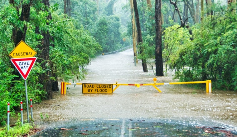
Seattle residents woke up to minor coastal flooding this morning, as the National Weather Service held fast to its coastal flood advisory until 8 AM PST. The affected communities, ranging from the lowlands of Western Skagit and Northwestern Snohomish Counties to the City of Seattle includes the Downtown Everett / Marysville Area, Shoreline / Lynnwood / South Everett Area, Lowlands of Pierce and Southern King Counties, and Island County, are all feeling the brunt of excess water.
The advisory, which was sourced from the National Weather Service Seattle, WA, indicated that a minor coastal flooding due to tidal overflow is expected around high tide, which could mean, that parking lots, parks, and roads might be under a couple feet of water. Although the situation is touted as "minor," commuters were urged to allow extra time due to potential road closures and to avoid driving through floodwaters.
In terms of the broader weather outlook, the rain isn't giving Seattle a break. The forecast, pinned dark and heavy with clouds, indicates that after 4 PM PST today, the area has a 60% chance of rain with new precipitation amounts between a tenth and a quarter of an inch possible. Looking ahead, the city doesn’t seem to catch a glimpse of a respite, with rain dominating the forecast for the upcoming week.
The weather woes continue into the night, with an expected 90% chance of rain, and winds that could gust as high as 20 mph, the National Weather Service confirms. As for Tuesday's forecast, Seattleites should brace for more rain, with the likelihood of precipitation climbing to 80%. Even the dawning of the weekend won't signal a change, as Friday is predicted to be mostly cloudy, again with a high near 46.
Local authorities remain concerned about coastal flooding following the wet forecast and are urging residents to take necessary precautions to protect flood-prone properties. Rising sea levels are pushing over natural and man-made barriers, putting residents in low-lying areas at risk as heavy rain continues.


