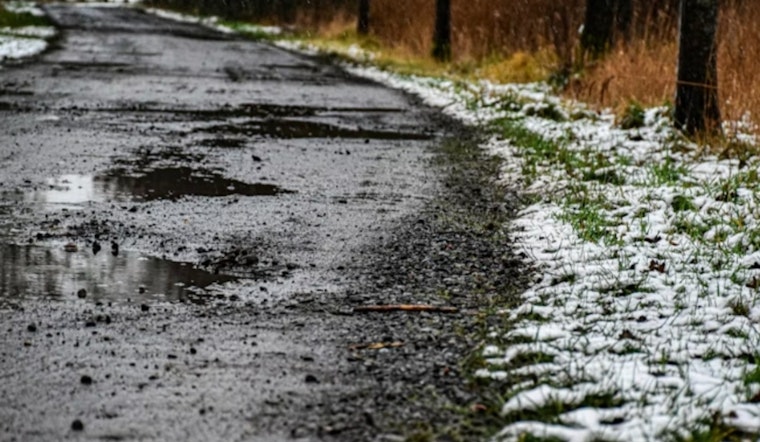
Milwaukee is waking up to a wintry mix of light snow and fog, with temperatures hovering near 30°F and roads turning slick just in time for the morning rush. The snow should fade after sunrise, but a light dusting or thin glaze of freezing drizzle could still turn that quick commute into a careful crawl. As per the National Weather Service, later in the day, gusty northwest winds will move in, keeping temperatures from climbing much and making the afternoon feel colder than the numbers suggest.
Morning Into Afternoon
Snow is expected to be most widespread before about 9 a.m., with scattered snow showers lingering into mid-morning. New accumulation should stay under about half an inch where any bands set up, so this is more of a nuisance event than a shovel-buster. A cold front will push through late morning into the afternoon, shifting winds to the northwest at 10 to 25 mph with gusts up to 35 mph and sending temperatures down into the low 20s. By tonight, wind chills are projected to drop below zero.
Some spots to the southwest could see brief freezing drizzle or a thin glaze of ice that makes bridges and ramps especially slick, so drivers will want to take it easy even after the flakes taper. These timing and impact details come from the National Weather Service, and the lake forecast and advisories are posted on the National Weather Service.
On The Lake
Out on Lake Michigan, conditions are gearing up to be downright hostile. Gales and a period of heavy freezing spray are expected across much of the lake from Friday into early Saturday. The mix of strong winds and bitter air can quickly coat vessels and gear in ice, turning routine trips into dangerous ones. Boat operators and anyone working along the lakefront should avoid exposed waters while warnings are in effect and follow official marine advisories closely.
Looking Ahead
Saturday will bring plenty of sun but not much warmth, with highs near 20°F and a much colder feel. There is a small chance for a quick burst of light snow late Saturday night into Sunday morning. Early next week looks more forgiving, with highs rebounding into the mid-30s and a warmer push possible by Tuesday before another chance of mixed precipitation returns by midweek. If you have outdoor plans, it is worth checking for updated forecasts as the pattern evolves.
Commute Tips
Plan for extra time on the roads this morning, especially on bridges and overpasses that can ice up faster than regular pavement. Slow down, give yourself extra stopping distance, and be ready for gusty crosswinds on more exposed stretches of roadway this afternoon. Before the stronger winds arrive, secure patio furniture and anything lightweight that might try to take flight. Travelers should keep an eye on transit or flight status, since slick roads and strong gusts can ripple into delays. Mariners, in particular, should steer clear of exposed waters while the warnings are posted.


