Honolulu is riding a warm, breezy afternoon on Sunday, with mid‑70s temperatures and partly cloudy skies at Daniel K. Inouye International Airport. Those gentle trades, though, are about to get a lot less friendly. Strong east winds are expected to ramp up through tonight into Monday, cranking up gusty conditions for both leeward and windward neighborhoods and funneling through island passes. A Wind Advisory is in place for many higher‑terrain and windward areas through 6 AM HST Monday, so anyone with outdoor plans will want to think twice before leaving things unsecured.
Wind Advisory Details
East winds of about 15–25 mph this afternoon are forecast to strengthen, with sustained speeds climbing into the 20–30 mph range and gusts potentially topping 50 mph in the windiest zones, particularly in mountain passes and immediately downwind of ridges. The Wind Advisory is in effect from 6 AM HST Sunday through 6 AM HST Monday, and forecasters warn that these gusts can rip off shingles, snap or drop tree branches, and make it a handful to steer high‑profile vehicles, according to the National Weather Service Honolulu.
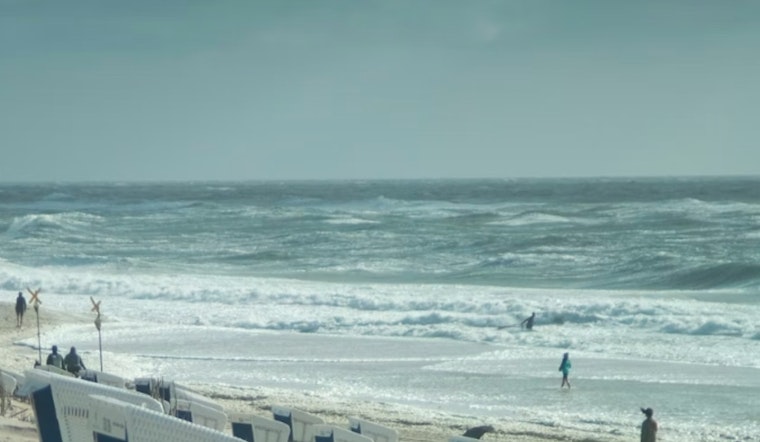
Marine And Surf
Out on the water, it is shaping up to be a rough ride. A Small Craft Advisory covers most nearshore waters through early Monday, and the Alenuihaha and Pailolo channels may see gale‑force winds. East‑facing shores sit under a High Surf Advisory, with building, wind‑driven surf expected tonight. Beachgoers are urged to stay off exposed east‑facing beaches, and boaters should secure small vessels or keep them in harbor.
How To Prepare
On land, the drill is simple but important: bring in or lash down outdoor furniture, tents and anything else that can turn into a projectile. Make sure trash and recycling bins are secured. If you have to drive, give large vehicles extra room and ease up on the gas over bridges and other exposed stretches. Anyone planning time on the water should strongly consider postponing, or at least check with local harbors and stay on top of updates, as this trade wind pattern could hang on into midweek.
More Info
We covered the build‑up to this blustery pattern yesterday, including early marine advisories and neighborhood‑level impacts. For a refresher on how we got here, check out our earlier report on how weekend trade winds whip up rough seas.


