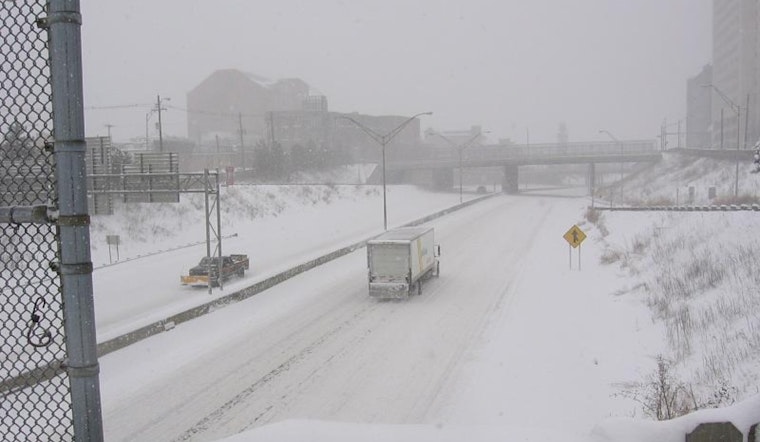
As Ohioans brave a wintry mix today, the National Weather Service in Wilmington has updated the region's cold weather situation, issuing advisories that put a significant portion of the state on alert. In their latest forecast discussion, the NWS anticipates a clipper system swiftly descending upon areas including Columbus and Cincinnati, with snowfall expected to impact visibility and road conditions throughout the morning.
The snow, predicted to accumulate 2 to 3 inches in the northeast two-thirds of Ohio, and 1 to 2 inches in the southwest, might reach intensities of an inch per hour within more active bands, "The snow will be banded in nature and within those bands, snow rates to around an inch an hour will not be out of the question, along with low visibilities," the NWS explained. Following these developments, a cold front is slated to push through late this afternoon, potentially triggering isolated snow showers and gusty winds that could lead to blowing snow; these weather conditions are the reason behind the cold weather advisory set tonight into Saturday morning, which is foreseen to bring wind chills dropping between zero and 15 degrees below across different parts of the state.
Transportation may face disruptions due to this system, with the NWS predicting IFR to VLIFR conditions in snow this morning for those flying in and out of the region, and north winds increasing overnight with gusts around 30 knots possible. "North winds will increase behind the front with gusts to around 30 knots possible into the overnight hours," the agency noted regarding aviation concerns.


