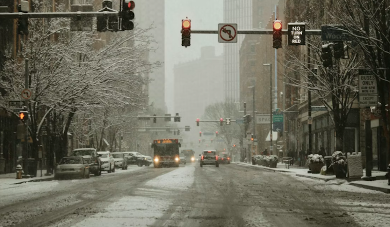
The Steel City braces for a winter wallop as an Alberta Clipper system aims, threatening substantial snowfall, fierce winds, and record-breaking cold temperatures. According to the National Weather Service in Pittsburgh. A recent weather update issued early this morning advises Pittsburgh area residents to ready themselves for a necessary hunkering down, as nature's icy grip tightens over the weekend.
Easing into today and sliding through to the early hours of Saturday, Pittsburgh can expect "1-3 inches" of snow in the lowlands, with 2-5 inches expected for the PA ridges, and a whopping "5-8 inches" anticipated for Tucker and eastern Preston counties in WV. The weather service cautions that blowing snow could impact visibility, especially in eastern Tucker County, where a High Wind Warning looms, forecasting gusts reaching up to 60 mph. This atmospheric turmoil anticipates a challenging Friday evening commute, with peak snowfall slated between 10 am and 5 pm Friday.
The weather service's advisories don't end with snowfall; a plunge in temperatures is set to cast an Arctic shadow across the region. Residents are warned to gear up for wind chill values plummeting to well below zero, with extreme cold expected north of Pittsburgh and in higher elevations. Saturday might just etch new frigid benchmarks into local weather records, with stated forecasts promising highs of meager teens—where Wheeling might bottom out at 14F, inching past its 17F record from 2007.
There's a snowy lining to the forecast, however. It seems next week might thaw some of the chill that's settled over Pittsburgh, as the weather outlook hints at a welcome potential warm-up. But this shift in the atmosphere isn't without its own set of complications—melting snowpack and accompanying rains might conspire to marry the region with flooding concerns. Keeping a watchful eye on local rivers, currently garbed in ice covered at a depth of 3 to 8 inches, the weather service underscores the risk for localized flooding as it juxtaposes the existing precipitation with the warming trend ahead.
For those eyeing the skies, aviation forecasts are just as muddled, with snow through the afternoon ushering in widespread restrictions and a cocktail of convective snow showers and embedded squalls forecasted for Friday night. Pittsburgh's weekend travel and outdoor plans might be on ice, yet the prospect of friendlier skies come mid-week may be the touch of hope needed to endure the winter's harsh crescendo.


