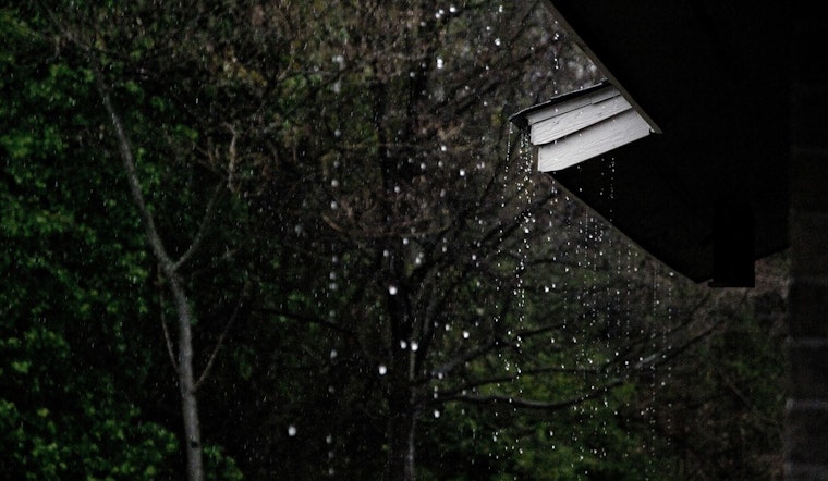
Raleigh is waking up to a gray, soggy Sunday on February 15, 2026, with light rain already falling and temperatures near 46°F at Raleigh–Durham International Airport. Showers are expected to fill in and become steadier through the afternoon and into tonight, keeping most of the Triangle wet into Monday morning. Forecasters are calling for widespread rainfall totals around 1 to 1.5 inches, with the heaviest amounts across the Piedmont, and isolated minor street flooding possible in low-lying or poor-drainage areas.
What To Expect Today
Rain is likely all day, with a cool high near 54°F and light southeast winds this afternoon. New rainfall of about a half to three quarters of an inch is likely today, followed by heavier rain tonight, when an additional 1 to 2 inches could fall, bringing storm totals to around 1 to 1.5 inches across much of central North Carolina. According to the NWS Raleigh, confidence is high that the region will see a steady, soaking rain through Sunday night.
Commute And Local Impacts
Drivers should plan on slower travel Sunday afternoon and into the evening; standing water and poor drainage can trigger brief slowdowns and isolated street flooding. Avoid driving through flooded roads and give yourself extra time to get around, as visibility and stopping distances will be reduced during heavier downpours. Anyone heading outside should bring waterproof gear and secure loose yard items that might wash into storm drains.
Looking Ahead
The rain is expected to taper early Monday, giving way to partly sunny skies and a high near 58°F on Monday, February 16. After that, a warmer and drier stretch moves in, with highs climbing into the mid-60s Tuesday and potentially reaching the 70s by Thursday and Friday, bringing mostly dry weather through much of the week. Check out the earlier weekend outlook for the prior forecast and additional context.


