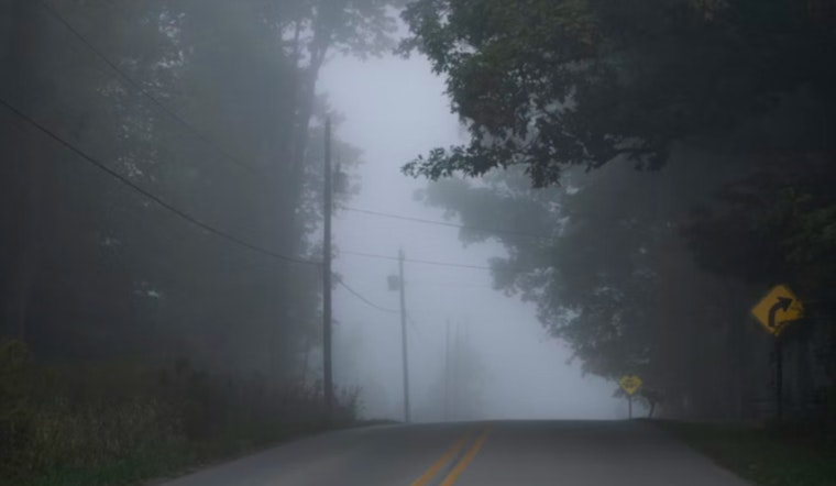
Drivers across the Sacramento Valley woke up on Monday to dense fog and mist, with visibility in some areas reduced to a few hundred feet and temperatures around 40°F, leading to slower-than-usual commutes and longer travel times. The heaviest fog is expected to lift by late morning, with sunshine returning across the valley.
Foggy Commute, Clearing by Midday
A Dense Fog Advisory remains in effect until 12:00 p.m. on Monday for the northern San Joaquin Valley and southern Sacramento Valley, according to the National Weather Service. Visibility may fall to a quarter mile or less, especially near rivers and the Delta, creating hazardous low-visibility conditions this morning.
Drivers are urged to build in extra time, flip on low-beam headlights, and be ready for sudden drops in visibility. Avoid stopping on freeway shoulders, and if emergency crews are directing traffic in the murk, follow their instructions carefully.
What to Expect Today
Patchy to locally dense fog is likely to hang around through the morning hours before skies gradually clear. Sunshine should break through by mid to late morning, helping to lift highs to around 65°F. East-northeast winds will stay light at roughly 2 to 5 mph, and overnight lows will slide back into the low 40s.
Once the sun sets, expect another round of shallow fog to redevelop after midnight into Tuesday in those same low-lying trouble spots.
Driving Tips
Caltrans District 3 is echoing the usual fog playbook this morning. Use low-beam headlights, slow down, and skip the high beams, which can actually make visibility worse by bouncing light off the fog.
If visibility drops, use the right-hand fog line as your guide, and do not pull onto the freeway shoulder unless there is no other option. Anyone who can delay travel until after the advisory wraps up around noon will cut down the risk for themselves and everyone else on the road.
Week Ahead
A ridge of high pressure is expected to settle in for the middle of the week, bringing a stretch of mild afternoons with highs in the mid 60s on Tuesday and Wednesday and repeated bouts of morning fog. There is a small chance of light rain late next weekend, although forecasters say timing and amounts are still fuzzy.
For now, it is a safe bet to plan outdoor activities for the sunnier afternoons and brace for a few more slow-motion starts to the day. We will post updates if the weekend outlook sharpens into a more definite system.


