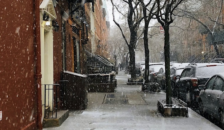
Light snow greeted New Yorkers early Wednesday, with temperatures hovering near 34°F and flakes sweeping in right on top of the morning rush. Roads, bridges and sidewalks may be slick in spots as temperatures start out below freezing before slowly climbing through the late morning. Snow totals across the five boroughs are expected to stay modest, generally under an inch, while inland areas and the Lower Hudson Valley could see a dusting to around 1–2 inches.
Morning Commute
Snow is forecast to fall mainly before 10 a.m., with the steadiest burst around daybreak, just when many commuters are heading out. Along the immediate coast, a slight changeover to rain is possible later in the morning. South to southwest winds around 10–15 mph will help nudge temperatures into the upper 30s and low 40s by midafternoon. A Special Weather Statement remains in effect into the late morning for hazardous travel during the commute, according to the National Weather Service.
Coastal And Marine
Closer to the water, including coastal neighborhoods and Long Island, the snow may flip to light rain a bit sooner. That should keep snow from piling up near the shoreline but can still leave behind slushy, messy streets. A Small Craft Advisory is posted for the ocean waters, Long Island back bays and eastern Long Island Sound through this evening, with seas potentially topping 5 feet offshore. Boaters and shore-side workers should be ready for gusty conditions and hazardous seas into tonight and, in some spots, into Thursday.
What To Do
Plan on a slower commute this morning: leave extra time, watch for black ice on bridges and untreated surfaces, and be prepared for brief drops in visibility when snow picks up. Check your transit provider for real-time service changes and consider signing up for alerts from Notify NYC for official updates. If you have to drive, take it easy on the gas, leave more room between cars, and expect patches of slush or refreezing through the morning hours.
Conditions should gradually improve as the day wears on, with skies clearing, highs near 42°F and winds backing off. Forecasters note that a weak clipper system could brush the area Thursday into Thursday night, bringing a small chance for a bit more light snow, and there is a broader chance for additional waves late this weekend into early next week. Travelers should keep an eye on forecast updates through the end of the week.


