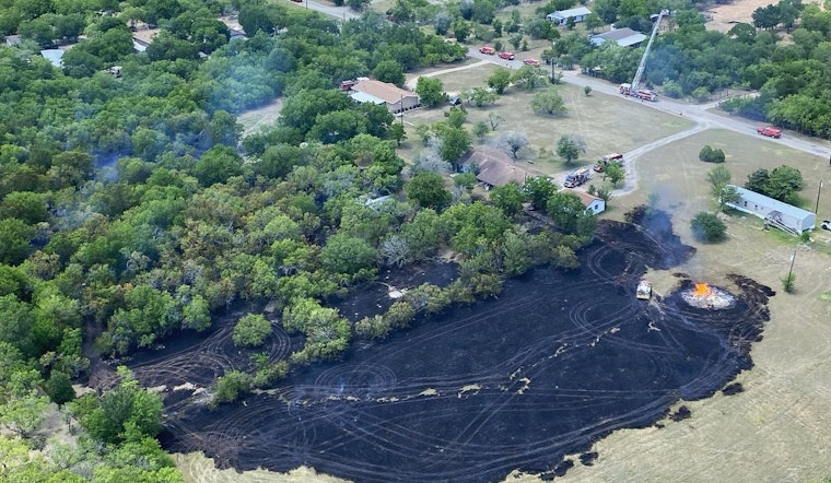
Travis County has quietly become the first U.S. county to put a commercial AI wildfire-planning tool into day-to-day use, and local fire leaders are hoping it will pay off where it counts: in the first crucial hours of an incident. The cloud-based platform is designed to flag likely ignition zones and crank out rapid scenario simulations so crews can get eyes on high-risk areas before small blazes have a chance to grow. Officials are pitching the system as a way to focus limited personnel and cut down on early uncertainty rather than a flashy replacement for the tactics they already trust.
During a recent demonstration, Travis County Fire Rescue Chief Ken Bailey walked through how the Mitigate system turns weather, vegetation, and operational inputs into a working field "game plan." Using the platform, he sent crews to assess potential hot spots identified on the map. The county says the pilot will involve Travis County Fire Rescue, Westlake Fire Department, Lake Travis Fire Rescue, and the Pflugerville Fire Department, and that membership costs are under $1,800. As reported by KVUE, officials repeatedly stressed that the tool is meant to act as a force multiplier for existing crews.
How the Mitigate platform works
FiSci’s Mitigate platform pulls together real-time environmental feeds, terrain and vegetation layers, and operational data, then turns that mix into "Risk From" and "Risk To" maps along with quick "what-if" scenario simulations to support mitigation planning. The company says the cloud-based SaaS can return actionable insights in minutes and can generate prescriptive treatment options plus key performance indicators such as flame height and fireline intensity. As outlined by FiSci, those outputs are intended to help land managers and fire agencies line up different mitigation strategies side by side and see which ones pencil out best.
Why local chiefs are optimistic
According to officials, one of the main selling points is how clearly the platform spotlights the neighborhoods and ridgelines "you need to be extra aware of in a particular operational period," as a FiSci team member told county staff during the demo. Chiefs say the ability to run many different scenarios in advance helps them prioritize drive-time checks and more targeted field assessments ahead of high fire danger days, instead of relying solely on broad regional forecasts. The demonstration and those comments were documented by KVUE.
Where this fits into Austin's strategy
The Mitigate pilot is rolling out alongside other local tech efforts, including Austin Energy's AI-driven smoke-detection camera network that feeds alerts into 911, as agencies try to speed detection and trim response times. Austin and Travis County have been expanding wildland-urban interface protections and mitigation programs as more homes sit closer to fuels, and that shift is part of why departments are putting predictive tools to the test now. For background on local wildfire exposure, see reporting from Community Impact.
County leaders say they will be tracking how the pilot performs as staff run more scenarios and compare them against what crews find in the field. The vendor, for its part, says it is working to broaden partnerships beyond Australia. FiSci is inviting agencies to schedule demos and is highlighting Mitigate's ability to quantify mitigation benefits and help optimise budgets for long-term resilience; learn more at FiSci.


