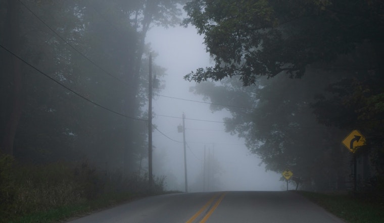
Jacksonville rolled out of bed Thursday, March 5, 2026, to a thick blanket of patchy fog, early morning temperatures in the low 60s, and headlights cutting through reduced visibility on the commute. The haze should thin by mid-morning, with mostly sunny skies taking over and inland highs topping out near 81°F. It will feel more like early summer than early March, especially away from the coast. Beachgoers, though, are staring down a high rip current risk from Ponte Vedra southward while inland areas flirt with record-challenging warmth. If your route runs through low-lying spots or along river corridors, the fog may make things interesting on the way in.
Foggy Start, Bright Finish
Areas of fog are expected before about 9 a.m., with the thickest patches near rivers and across the St. Johns basin. After that, skies should trend mostly sunny by late morning. Southeast winds will stay on the lighter side, generally 2 to 12 mph, and the juicy humidity in place will help fog redevelop overnight. Locally dense fog is on the table each morning through the weekend. Highs will climb to around 81°F inland and the upper 70s along the beaches, easing back a few degrees later in the afternoon.
Beach Hazards: Rip Currents Running High
The National Weather Service is calling out a high rip current risk from Ponte Vedra southward, with breakers around 3 to 4 feet in spots and an elevated risk along the rest of the shoreline. Mariners should be ready for periods of dense sea fog overnight. If you are heading into the surf, stick close to lifeguards, skip the solo swims, and if you get caught in a rip, float, stay calm, and signal for help instead of trying to overpower the current. You can find more background on yesterday's fog and surf warnings.
Sea Breeze, Light Showers and a Warm Stretch Ahead
An onshore southeasterly flow will shove a sea breeze inland this afternoon, with gusts around 10 to 15 mph and slightly cooler readings right along the coast. A few isolated, mainly inland showers or a stray thunderstorm are possible later today and this evening near the I-75 corridor, but rain chances stay low. Above-normal warmth looks locked in for several days, with inland highs rising into the mid 80s later this weekend and overnight lows holding in the low to mid 60s.
Commute Caution and Safety Reminders
On the roads, slow down in fog, use low beams instead of high beams, leave extra room between cars, and be prepared for sudden slowdowns near river valleys and bridges. At the coast, follow lifeguard instructions and posted flags. Boaters should be ready for stretches of poor visibility from sea fog overnight and into the morning hours. For the latest forecast updates and any advisory changes, check the National Weather Service in Jacksonville and local outlets before heading out.


