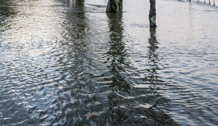
Friday morning's drive on Oʻahu's windward and North Shore corridors turned into a slog as Hawaiʻi Department of Transportation crews reported that deep water and slide debris had rendered multiple stretches of Kamehameha Highway impassable. Motorists ran into roughly four feet of standing water between Laniākea and Waimea Bay, while debris and a possible landslide blocked lanes near Kaaʻawa and Kahana Bay. The mess hit right in the middle of the morning rush, triggering emergency work and heavy traffic delays.
Crews reporting 4 ft of water on Kamehameha Hwy between Laniakea and Waimea Bay. Debris reported on Kamehameha Hwy southbound near Kaaawa Beach Park. Debris from possible landslide on both lanes of Kamehameha Hwy near Kahana Bay. https://x.com/i/status/2035027561219338728
- Hawaiʻi Department of Transportation (@dothawaii) March 20, 2026
According to the Hawaiʻi Department of Transportation, crews found about 4 feet of standing water on Kamehameha Highway between Laniākea and Waimea Bay, debris on the southbound lanes near Kaaʻawa Beach Park, and additional debris from a possible landslide that blocked both lanes near Kahana Bay. The post was time-stamped March 20 and tagged with #hitraffic and #hiwx as teams began their assessments. The department said emergency crews were on scene working to clear water, rocks and other slide debris.
Where the highway was hit
The trouble was concentrated on the windward and North Shore segments of Kamehameha Highway, a coastal route that officials have repeatedly flagged as vulnerable to wave runup, erosion and rockfall. Hawaii News Now has recently detailed road rehabilitation and emergency repair work in the corridor, and the state DOT maintains a project page that outlines shoreline stabilization and emergency fixes at Kaaʻawa and near Waimea Bay. That backdrop helps explain how damage in a relatively short stretch can quickly ripple into major traffic disruption along this exposed coastal highway.
What drivers should expect
Drivers should brace for lane closures and long delays while crews pump out the standing water and remove slide material. The DOT's post noted that personnel were already on scene with traffic control in place, and motorists are urged to stay away from the affected corridor if possible and to follow instructions from workers on the ground. Anyone headed to North Shore beaches or the windward side should allow extra travel time or use inland alternate routes until all lanes are cleared and reopened.
Why this keeps happening
Sections of Kamehameha Highway have taken repeated hits from coastal erosion and rockfall, leading to a string of emergency repairs and longer-term projects intended to make the route more resilient during storms. Hawaii News Now has reported on federal grants and resilience projects aimed at the corridor, and state DOT project pages describe ongoing shoreline work and slope-stabilization efforts. Those chronic vulnerabilities mean that heavy runoff or a single slope failure can shut the road quickly and strand drivers until crews finish clearing and repairs.
This story will be updated as official agencies and first responders release more information. Until then, travelers are advised to monitor local traffic feeds and news outlets for the latest detours and conditions before heading out along Oʻahu's windward coastal routes.


