Milwaukee rolled into early Tuesday with mostly clear skies and a mild 63°F at Mitchell International, but the calm is on borrowed time. Forecasters expect thunderstorms before and during the midday commute, with temperatures sliding into the upper 40s by late afternoon.
What To Expect Today
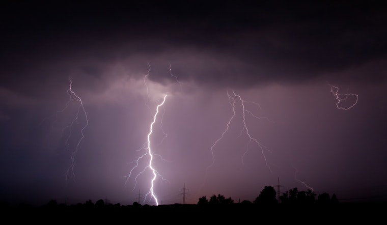
A round of showers and thunderstorms is on tap before noon, followed by more widespread storms through the afternoon and evening. Daytime highs should top out near 63°F, then drop into the upper 40s later in the day. New rainfall totals of about a quarter to a half inch are possible, and any stronger storms could throw down large hail and gusty winds. Plan on slower travel for afternoon errands and pack the rain gear for the midday commute, according to the National Weather Service Milwaukee/Sullivan.
Afternoon Winds And Commute
As the cold front sweeps through Tuesday afternoon, winds will flip from the southwest into the north and northeast, making it feel noticeably cooler. Gusts could reach into the 20 to 30 mph range behind the front, so think twice about leaving lightweight outdoor items unsecured. Drivers and cyclists should build in some extra time for the evening commute. If you have outdoor plans for this afternoon, consider moving them earlier in the day or bringing them inside.
Wednesday Into Thursday
Forecasts for the midweek system have nudged a bit farther north, which keeps the main wintry mix of snow, sleet and freezing rain focused on areas generally north of Highway 18 and Interstate 94. That is where travel impacts are most likely. Farther south, heavier rain and a few thunderstorms are possible Wednesday night into Thursday, with some spots picking up around 1 to 2 inches of rainfall. Residents should keep an eye on updates from the National Weather Service as the system approaches.
On The Lake
Small craft advisories may be posted as gusty winds and choppy waves build across parts of southern Lake Michigan, with the northern and southern thirds of the lake most likely to see the strongest gusts. Boaters and shoreline anglers would be wise to skip open-water trips while the front and showers move through, in line with the earlier look at this wild weather week.
Keep a close eye on local radar and National Weather Service alerts for any warnings this morning. If you have to drive through heavy rain or storms, slow down and leave extra room to stop. We will update readers if watches or warnings are issued.


