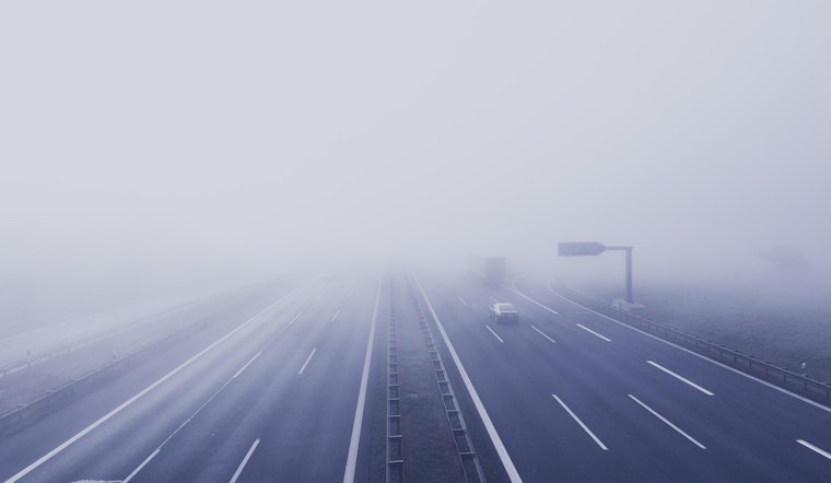
Milwaukee commuters got an unwelcome wake-up call Wednesday, March 4, 2026, as thick, travel-sapping fog settled over the city and much of southeast Wisconsin. Visibility dropped to a quarter mile or less in some spots, and a Dense Fog Advisory is in effect until 9 a.m. CST, making the early drive a slow, white-knuckle affair across parts of the region. Expect slower-than-normal travel on surface streets, highway ramps and along the lakefront until the low clouds finally burn off.
What Drivers Should Know
The advisory is blunt about what motorists are driving into: "If driving, slow down, use your headlights, and leave plenty of distance ahead of you," it says. The Dense Fog Advisory covers Rock, Kenosha, Milwaukee, Racine, Walworth and Waukesha counties and warns that visibility could fall to a quarter mile or less. For the official advisory and full county list, see NWS Milwaukee/Sullivan.
Foggy Morning, Partly Sunny Afternoon
Forecasters expect the widespread fog to lift by mid-morning, with skies turning partly sunny and a high near 45 degrees Fahrenheit. East winds will stay on the light side, around 0 to 5 mph. Tonight, clouds thicken again with a 50 percent chance of light rain and a low around 37. Only small rainfall amounts are expected early on, but damp pavement could be enough to slow the evening commute, according to NWS Milwaukee/Sullivan.
Late-Week Soaker And Thunder Risk
A stronger storm system moves in Friday, setting the stage for a widespread rain event, embedded thunderstorms and a much milder high near 59 degrees. Forecasters expect a quarter to a half inch of rain in many locations Friday into Friday night, with heavier bursts and brief thunder possible, so outdoor plans may need a backup. A cold front will sweep through Saturday morning, knocking temperatures back into the upper 40s and kicking up breezy northwest winds.


.jpg)