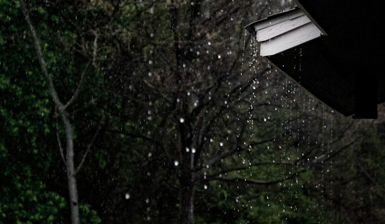
Seattle woke up to a gray, drippy start Tuesday, with light rain falling across the city and temperatures stuck in the mid-40s. The result for the morning commute: wet pavement, splashy lanes, and reduced visibility whenever the showers briefly intensify.
According to the National Weather Service Seattle, the rain is expected to persist through Tuesday, with most lowland areas picking up between one half and three quarters of an inch. South winds of 6 to 18 mph will be common around the city, with gusts near 24 mph. Along more exposed coastal and north interior locations, forecasters are calling for stronger gusts in the 30 to 50 mph range, and have issued wind advisories and marine gale warnings for parts of the region.
Afternoon Gusts And The Commute Crunch
The strongest push of wind is expected this afternoon into early evening, which could make the ride home a bit more interesting than anyone wants. Bridges and shoreline routes will feel it most, with noticeably stronger gusts funneling across open stretches.
If you drive or bike, plan on some extra travel time, secure any loose backyard furniture, and give high-profile or larger vehicles a wide berth. In more exposed neighborhoods, forecasters note there is a chance for falling branches and scattered power outages.
Marine And Mountain Conditions
On the water, gale warnings cover many coastal zones and portions of Puget Sound, with seas building well into the double digits and rough conditions expected to linger into Wednesday. Boaters should be ready for a choppy ride.
Up in the Cascades, a brief period of heavier snow is possible this morning at Mount Baker. Snow levels will wobble a bit but are forecast to drop back down to around 2,500 feet by Wednesday, which could mean slushy passes at times and brief travel disruptions through the higher routes.
The Week Ahead
After this system moves through, the pattern is expected to calm down toward the end of the week. Showers ease off and give way to drier, slightly warmer conditions on Thursday, with highs returning to the low to mid 50s and climbing toward the upper 50s over the weekend.
Hydrologists are not expecting river flooding from this round of weather, although localized standing water could still slow things down on city streets and highways.
For more context on the recent blustery pattern in western Washington, see our windy Wednesday splash zone recap. If you have travel plans, check real-time updates from transit agencies and WSDOT before heading out, since ferries and some high-profile routes may see delays or temporary restrictions.
In the meantime, keep the umbrella close, steer clear of driving through standing water, and if you come across a downed power line or a tree blocking the road, call 911 and report it to Seattle City Light. We will share updates if advisories or warnings are adjusted as the system moves through.


