San Antonio woke up to mostly clear skies and about 55°F early Saturday morning, March 14, 2026, with pockets of patchy fog clinging to low-lying spots. That fog should thin by midmorning, and highs are expected to climb near 86°F with light south-southeast winds, setting up a warm, dry day.
Foggy Morning, Sunny Afternoon
Patchy fog is expected between roughly 8 and 9 a.m., mainly near creek bottoms and lower neighborhoods, before a shallow deck of low clouds burns off. Once the clouds erode, look for mostly sunny skies and a mild breeze of 0–10 mph through the afternoon, more spring preview than storm setup.
Sunday Heat Then Rapid Turn To Windy Cold
Sunday is the main plot twist. Highs in San Antonio should jump into the low 90s, with even hotter readings in the mid 90s farther west and south. A dryline will shove east during the day, followed by a strong cold front late Sunday into Sunday night that is forecast to bring sustained north winds of 20–35 mph, with gusts blasting up to 45–55 mph. The National Weather Service has issued a Fire Weather Watch for the region from Sunday afternoon through Monday evening, warning that low humidity and strong winds could lead to critical fire weather conditions, according to NWS Austin/San Antonio.
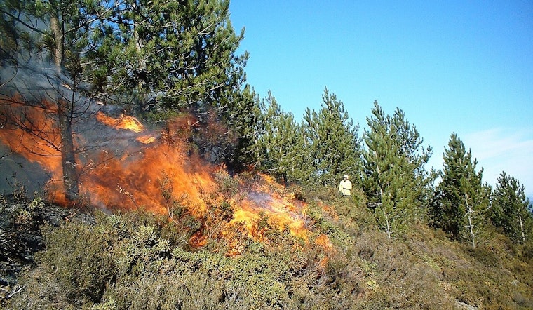
Impact And Legal Implications
With that kind of wind and dryness, any spark could spread quickly Sunday and Monday, so residents are urged to avoid open burning and spark-producing work. The Bexar County Fire Marshal's office currently has a countywide burn ban in effect, and people are asked to report smoke or unattended fires immediately and follow local restrictions, per the Bexar County Fire Marshal. Beyond the ban, officials advise avoiding parking on dry grass, securing lawn equipment, and skipping outdoor welding or debris burns until humidity recovers and winds relax.
Timing And What To Do
Before winds really crank up Sunday evening, secure outdoor furniture, trash bins, and other lightweight items that could go airborne when gusts peak. Drivers of high-profile vehicles should be ready for strong crosswinds in the north flow. There is also the potential for a freeze Monday morning, so protect sensitive plants by covering them or bringing pots inside, and keep an eye on the latest forecasts before heading out through Monday night.
If you spot smoke or an active blaze, call 911 immediately. For the latest watches and warnings, follow local officials and the National Weather Service as conditions evolve.


