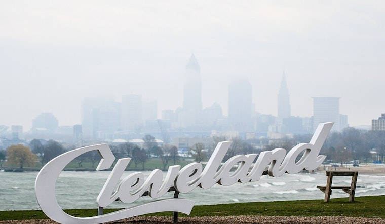
Cleveland is starting Friday under a blanket of dense fog, with visibility early this morning dropping to roughly a quarter-mile and temperatures stuck near 50°F for the commute. The fog is expected to lift by mid- to late morning, but drivers should bank on slower travel during the advisory and flip on the headlights whenever the view ahead turns into a gray wall.
Morning Commute and Today's Forecast
Once the fog finally peels back, skies should turn partly sunny this afternoon, with highs climbing to around 68°F and a light northerly breeze at 3 to 5 mph. The Dense Fog Advisory is in effect until 11 a.m., and area airports could be dealing with IFR/LIFR conditions until the fog clears. The advisory and forecast discussion are posted by NWS Cleveland.
Severe Storm Risk Saturday
Saturday brings a strong cold front and a sharp change in tone, with temperatures pushing to around 76°F and a very high chance of afternoon and evening showers and thunderstorms. Forecasts call for widespread storm coverage and a 90% chance of rain, with the stronger cells packing the potential for damaging wind gusts, large hail, and even an isolated tornado or two. If you have outdoor plans, be ready to move the party inside and have multiple ways to receive warnings if storms start to fire.
Late Weekend Cool Down and Frost Risk
Rain and thunderstorms may linger into Saturday night, with localized rainfall totals between one-half and three-quarters of an inch possible and gusts around 25 to 30 mph in the stronger storms. Cooler air settles in on Sunday, pulling highs back to around 52°F with a chance for spotty showers. In the higher terrain of northwest Pennsylvania, some of that moisture could briefly flip to wet snow Sunday night, though little to no accumulation is expected. The colder nights Sunday and Monday raise the threat of frost or even a freeze in low-lying and rural areas, so it is time to think about protecting sensitive plants and exposed outdoor plumbing.
Staying Safe
If you have to drive through the fog this morning, ease off the gas, stick with low beams, and leave extra room for stopping while visibility stays low. Before you head out today or lock in any Saturday plans, check the latest watches and warnings, and make sure you have an indoor backup ready if the storms move in right on cue.


.jpg)