Wednesday night the National Weather Service put parts of southeast Wisconsin on flood alert, and the Fox River through downtown Waukesha was among waterways expected to climb above flood stage. Gauges were already reporting minor flooding in several locations and forecasters warned the river could crest near eight feet overnight, threatening low-lying parks and the riverwalk. Local officials urged residents to keep clear of riverbanks and to avoid driving through standing water.
According to the National Weather Service in Milwaukee/Sullivan, the agency issued a flood warning Wednesday at 11:23 p.m. CDT for multiple rivers, including the Fox River Lower at Waukesha, the Rock River at Jefferson and the Sugar River at Brodhead, and said some advisories will remain in effect into late Saturday evening. The NWS also scheduled another statement for Thursday morning at 11:30 a.m. CDT to refresh forecasts and impacts.
The Waukesha Police Department shared the NWS advisory on its Facebook page and echoed the agency's safety guidance, urging people to stay away from floodwaters and not to drive around barricades. The department's post links readers to the same forecast details and warns that emergency crews are monitoring the riverfront overnight.
What the gauges show
According to the National Weather Service, the Waukesha gauge was around 7.1 feet late Wednesday with a 24-hour maximum near 7.4 feet, and forecasters projected a crest near 7.9 feet just after midnight, above the 6.0-foot flood stage and well over the 5.0-foot bankfull mark. The NWS says that at higher stages water will spill into lowlands and along riverfront trails. Officials reiterated the familiar admonition, "Turn around, don't drown," noting that most flood deaths occur in vehicles.
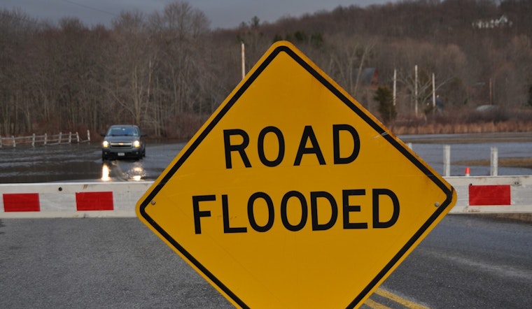
Where flooding could hit
The NWS product lists specific low-lying areas that would be underwater at about 8.0 feet, including parts of Corrina Boulevard, Buckley Street and Dunbar Avenue, plus Grede Park, the Glacial Drumlin Trail and the Fox Riverwalk, details that the Waukesha Police Department shared on Facebook. City crews have been watching Frame Park and other riverfront plazas and may close trails or parking lots if levels continue to climb. Motorists should expect localized closures near the river and obey posted barricades.
How to stay safe
Local broadcasters and emergency officials echoed the NWS advice to avoid walking or driving into floodwater, move valuables to higher ground if your property sits in a low spot, and keep children and pets away from currents. FOX6 and other outlets are carrying updates, so residents are urged to monitor official channels for road-closure notices and check the NWS statements for forecast changes.


