Honolulu woke up sticky and gray on Thursday, April 9, 2026, with temperatures hovering near 75°F and south‑southeast winds already on the move. Early showers are sliding across the island and forecasters say a more organized, wetter band later today could fire up heavy thunderstorms. That one‑two punch of rain and gusty winds is setting the stage for flash flooding, downed branches and tricky coastal surf around Oʻahu.
When The Heaviest Rain Arrives
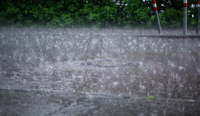
Widespread showers and thunderstorms are most likely on Thursday, April 9, with the most intense rain expected Thursday night and continuing into Friday, April 10. The National Weather Service has a Flood Watch up for all islands through Friday afternoon and notes that some spots could see 2–3 inches of rain Thursday, with totals topping 4 inches possible from Thursday night into Friday. High Wind Warnings remain in effect for wind‑exposed mountain slopes on Kauai and Oʻahu, and strong southerly gusts that may exceed 30 mph are forecast to ride in with the heavier bands.
Coastal And Marine Concerns
A High Surf Advisory continues for south‑facing shores of Niʻihau, Kauai and Oʻahu through 6:00 AM HST Friday, April 10, with large, sloppy surf in the 8–12 foot range and strong rip currents. Gale Warnings and Small Craft Advisories are posted over portions of the coastal waters, so mariners should be ready for very rough seas and potential harbor closures tonight into Friday. For a look at how similar setups have played out recently, including soupy skies and street floods, check local impact reports.
Commute And Outdoor Plans
Drivers should expect slow, messy commutes when the heavier bursts roll through, with brief flooding on low‑lying roads and poor visibility in the strongest showers. Daniel K. Inouye International Airport could see delays during the peak bands, so travelers should check with airlines and county traffic updates before heading out. Outdoor events, beach outings and small‑boat trips are best postponed or given a solid backup plan.
How To Stay Safe
Avoid driving through standing water, move valuables out of basements or other low‑lying spaces, and secure anything outside that could turn into a projectile in stronger gusts. If water in a stream or gulch starts rising quickly, get to higher ground right away and follow guidance from county emergency channels; call 9‑1‑1 only for life‑threatening emergencies. Keep phones charged and stay tuned to the National Weather Service and county alerts for updated watches and warnings.


