San Antonio woke up under a thick, muggy blanket of clouds this morning, with temperatures in the low 70s and humidity pushing close to 90 percent. Showers and thunderstorms are expected on and off through the afternoon and again tonight, and a few could ramp up to strong or even severe levels. Highs should top out near 79°F, with lows settling around 70°F by early Monday.
What To Expect
According to the National Weather Service Austin/San Antonio, showers and thunderstorms are likely before 1 p.m., with a 70% chance of rain and heavier rounds possible into the evening. Some storms could pack large hail and damaging wind gusts, and the strongest cells may drop between three quarters and one inch of rain, enough to trigger brief urban and highway flooding in the usual trouble spots.
Timing And Commute
A line of morning storms sliding out of the Hill Country toward the I-35 corridor could bring the day’s roughest weather to central neighborhoods by midday, with more storms potentially firing after dusk. We flagged this setup in a muggy April 10 outlook, and residents should brace for slower commutes, standing water on low-lying roads, and pockets of reduced visibility during heavier downpours.
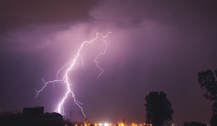
Safety Tips
Never drive through flooded roadways, turn around, do not drown, and keep your phone charged in case weather alerts start buzzing. Secure loose outdoor furniture, move any outdoor plans indoors if you can, and avoid sheltering under trees during lightning. If you know your usual route crosses a flood-prone intersection, plan an alternate way around it.
Looking Ahead
The unsettled pattern looks to hang around into early next week, with daily chances for scattered storms and highs climbing into the mid-80s on Monday and Tuesday. Keep an ear on weather radios and local alert services if you have evening plans, as officials say the setup could deliver additional rounds of locally heavy rain through Wednesday.


