Monday, April 13, 2026, started cloudy and mild around 70°F in Cleveland, but the morning commute is more bluster than bliss as southwest winds ramp up. A Special Weather Statement is flagging gusts up to about 45 mph early today, with breezy conditions hanging on into the afternoon. Highs should top out near 75°F, and there is a chance of scattered showers and isolated storms tonight.
Afternoon Winds Pick Up
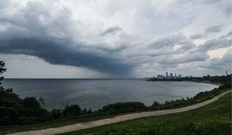
Through the midday and afternoon hours, southwest winds of 13 to 18 mph are expected, with gusts in the 25 to 35 mph range and some stronger bursts along more exposed lakeshore spots. On Lake Erie, boaters are dealing with Small Craft Advisories. The advisory for the western basin is expected to expire around 10 a.m., while the rest of the lake could stay at advisory levels into the afternoon.
The active pattern carries into Tuesday, with a higher chance of showers and thunderstorms late Tuesday into Tuesday night, so it is worth keeping an eye on any new warnings. According to the National Weather Service in Cleveland, periodic showers and rounds of thunderstorms are likely through Thursday, and temperatures should stay above normal.
Tuesday Night Risk
The bigger concern arrives late Tuesday into Tuesday night, when a stronger system could trigger more organized storms across northern Ohio. If storms line up, damaging straight-line winds and large hail would be the primary threats. Timing and coverage are still uncertain, so plan to monitor any warnings on Tuesday evening. Wednesday looks cooler and wetter, with pockets of moderate to heavy rain possible in some locations.
What To Do
Before heading out, tie down patio furniture and secure loose trash cans, since this morning’s gusts could shove around anything that is not anchored and make driving tricky, especially for high-profile vehicles. Small boats should stay in port while advisories remain in effect, and anyone with outdoor plans Tuesday night should have a sheltered backup option ready. Keep your phone charged and local weather alerts enabled so you get warned quickly if conditions escalate.
Where This Fits With Earlier Coverage
We flagged a wind-prone pattern in March, but this Special Weather Statement is a same-day update that zeroes in on today’s gusty conditions and the latest timing on showers, so it represents a substantive change. For background on that earlier wind setup, see our previous Hoodline piece on the wind-whipping storms that lined up through Wednesday.


.jpg)