New York City is spending Saturday, April 11, 2026, under a breezy, bone-dry setup that has forecasters on edge about fire danger. The day started partly cloudy with temperatures in the mid-50s and northwest winds already picking up. Gusts are expected to strengthen into the late morning and early afternoon, with sustained northwest winds of 15–21 mph and pockets of 20–30 mph, while humidity dips into the mid-20s. The high should top out near 64°F before winds ease this evening.
Elevated Fire Risk This Afternoon
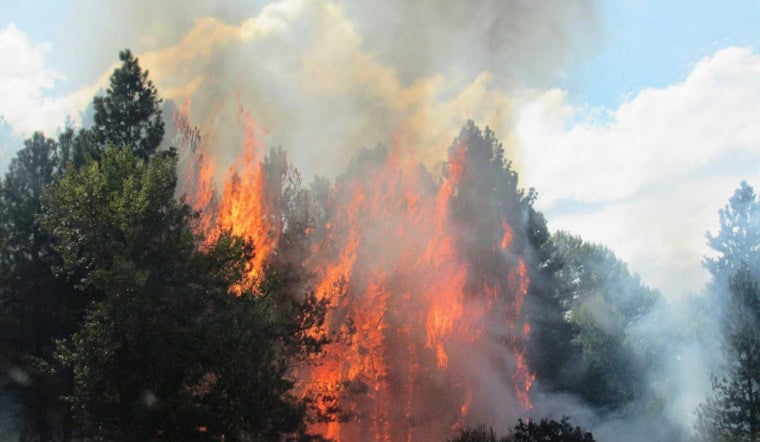
The National Weather Service in Upton has issued a Special Weather Statement flagging an elevated risk for fire spread across southeast New York on Saturday. Forecasters say relative humidity could fall to 25–30 percent while northwest gusts reach 20–30 mph, drying out fine fuels and raising the odds of rapid fire growth, according to NWS Upton. People in brushy or suburban areas are urged to skip any outdoor burning and be extra careful with anything that can throw a spark until winds back off this evening.
Afternoon Winds Pick Up
The bluster will stick around through the afternoon as a cold front pushes east. The steady breeze and higher gusts could make walking across exposed bridges or biking in open stretches a bit of a battle. City officials suggest securing loose patio furniture, trash cans and tarps, and building in some extra travel time on bike and bus routes where gusts are expected to jump into the 20s. Temperatures will drop quickly after sunset as high pressure builds in from the west.
Marine Advisories
Small craft advisories are posted for New York Harbor and the Long Island south shore bays from Saturday morning into the afternoon, with hazardous ocean seas near 5 feet keeping advisories in place for the ocean through the evening, according to the National Weather Service. Inexperienced boaters are urged to stay in port, and all mariners should secure gear and plan for choppy, uncomfortable conditions. Calmer seas are expected once winds relax tonight.
What To Expect Next Week
Sunday will feel noticeably cooler, with highs back in the low-to-mid 50s. After that, the weather does a quick about-face. A strong warm-up is expected early next week, with Monday into midweek turning much warmer. Inland highs are projected to climb into the 70s and 80s by midweek, with only modest cooling along the shoreline. An afternoon shower or brief thunderstorm is possible inland Monday or Tuesday, so it is worth checking updated forecasts if you are planning outdoor events later in the week.
Legal Implications
On top of the weather concerns, open burning of brush, leaves and yard debris is prohibited statewide through May 14 under New York's annual spring burn ban. Violations can trigger enforcement actions and fines, the NYSDEC notes. Prescribed burns carried out by trained crews under permits are exempt, but casual backyard debris fires are off the table until the ban is lifted.
Related Coverage
For a broader look at why forecasters are so wary of days like this, regional officials point to the wider tri-state fire risk and ongoing guidance from land managers. Hoodline has more on how low humidity and gusty winds across the Hudson Valley and the tri-state spurred coordinated warnings from agencies and fire experts. Weekend winds raise tri-state fire fears breaks down the setup behind the alerts.


