Honolulu is waking up warm and muggy, with temperatures hovering near 73°F at Daniel K. Inouye International Airport and scattered morning showers expected to taper off before midday. The bigger story for anyone eyeing the sand is a High Surf Advisory for south-facing shores, in effect through 6 p.m. HST on Sunday, May 31, with sets building to 7 to 10 feet. Forecasters say the afternoon high tide could push seawater over normally dry parts of the beach, so expect periodic wave runup along popular shoreline spots.
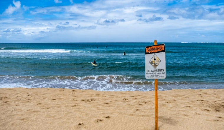
High Surf And Beach Hazards
The National Weather Service has posted the advisory, calling for 7 to 10-foot surf and warning of "periodic wave runup" this afternoon that can quickly sweep people and gear off low-lying beaches. According to NWS Honolulu, the advisory remains in place until 6 p.m. HST and could lead to beach or harbor restrictions if conditions ramp up later in the day.
Showers, Temperatures And Winds
Scattered showers are most likely before noon, then skies should turn mostly sunny with afternoon highs near 84°F. Northeast winds will stay on the lighter side at roughly 7–13 mph this afternoon, becoming stronger and gustier into Monday as the trade winds return. Brief but heavy downpours may cut visibility along mauka routes, so drivers should be ready for wet pavement and quick-changing conditions during the morning commute.
What To Do Today
If you are heading to the beach this afternoon, stick to lifeguarded areas, give rocky points plenty of space and do not turn your back on the ocean, even if the shoreline looks calm. For any beach closures, warning flags or real-time updates on conditions, check with Honolulu Ocean Safety; lifeguards may shut down access or post alerts as the south swell and high tide overlap. Keep children and pets well away from the waterline, and secure any loose beach gear so it does not disappear with a sudden wave runup.


