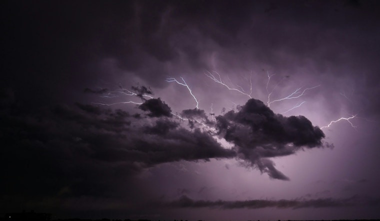
Strong thunderstorms rolled over Washington and Tyrrell counties Tuesday evening, prompting a Special Weather Statement from the National Weather Service that called out wind gusts up to 40 mph and even the chance of a brief landspout near Scuppernong. Small communities including Woodley, Scuppernong and Creswell were put on notice as the advisory stretched into the early evening, creating tricky conditions for anyone outside or driving local roads.
NWS Advisory Details
According to the News & Observer, the National Weather Service office in Newport/Morehead City reported that, at about 5:08 p.m., Doppler radar was tracking a storm capable of producing a landspout roughly 13 miles east of Plymouth, moving east at about 15 mph. The statement warned that “minor damage to outdoor objects is possible” and listed the advisory as active until 5:45 p.m.
Safety And Lightning Risk
Forecasters urged anyone in the path of the storms to get indoors and stay put, recommending people wait 30 minutes after the last lightning or thunder before heading back outside. The National Weather Service's lightning safety page points out that lightning hits the U.S. about 25 million times a year and kills around 20 people annually, a sober reminder that even a quick-moving storm can turn deadly.
What To Watch For
The NWS advised, “If outdoors, consider seeking shelter inside a building.” Gusty winds could snap tree limbs and send unsecured items tumbling, which means trouble for drivers and the potential for downed power lines. For the full rundown, check the advisory from the National Weather Service in Newport/Morehead City.
Local Context
This alert arrived amid a broader burst of fast-hitting but intense thunderstorms across North Carolina on Tuesday, with multiple NWS offices posting similar statements for both coastal and inland counties, according to the News & Observer's weather feed. The string of short-lived advisories is a reminder of how quickly conditions can flip from routine to hazardous for anyone working outside or traveling local roads.
If you are in or near the affected areas, keep tabs on updated forecasts and guidance from emergency officials and broadcasters. Stay tuned to NOAA Weather Radio or local media for any changes to warnings or new safety instructions.


